Yellow and blue trail from Krynica-Zdrój to Góra Krzyżowa and Słotwiny tower
Nearby: Nowy Sączbeach_access Route in the shade
restaurant Restaurant or bar nearby
directions_bus Can be reached by bus
train Access by train possible
wc Toilet along the route
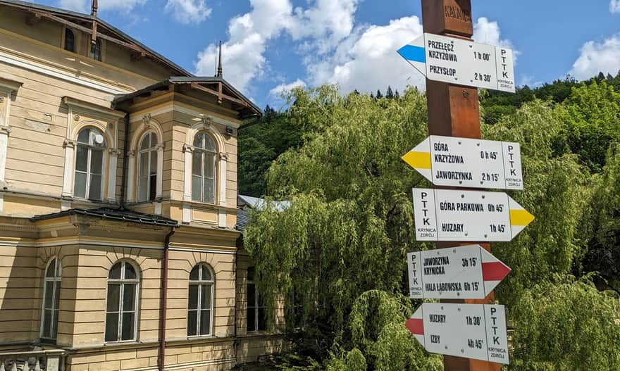
The blue and yellow trails start from the main promenade in Krynica-Zdrój and lead to the scenic Góra Krzyżowa, and then to Drabiakówka, including the observation tower and tree-top walk in Słotwiny. The route goes through the forest, but there are several beautiful viewpoints along the way.
Start of the yellow and blue trails in Krynica-Zdrój
Both the yellow and blue trails cross Krynica-Zdrój near the main promenade of the spa town. One direction leads to Góra Parkowa, the other to Góra Krzyżowa and the Słotwiny tower.
Yellow and blue trail - ascent to Góra Krzyżowa
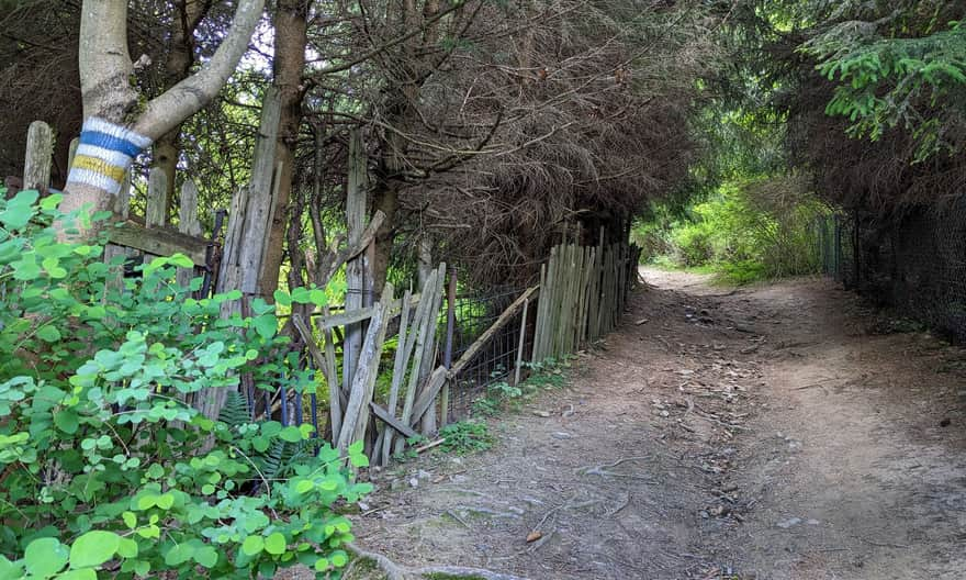
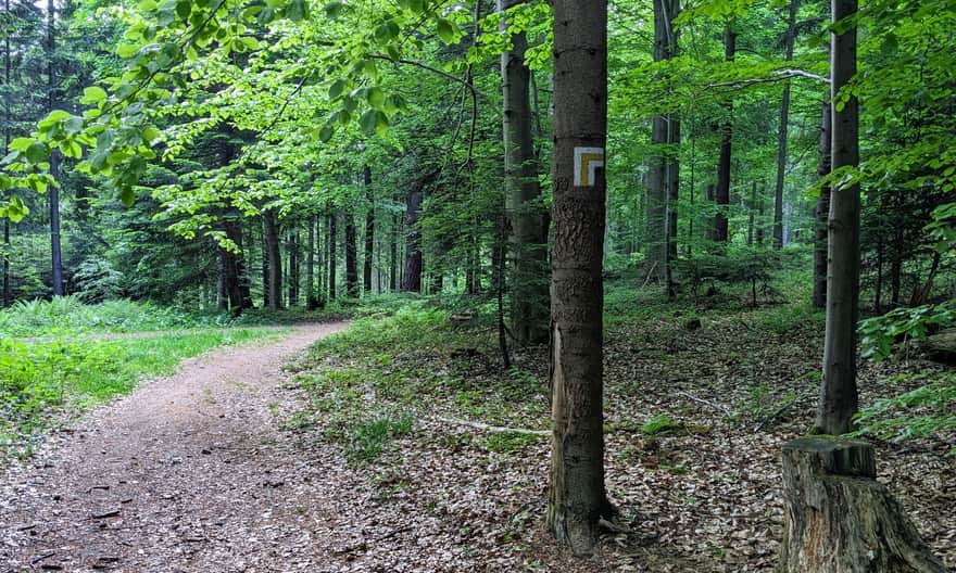
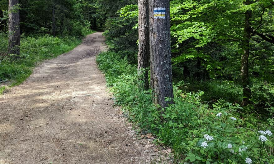
After entering the forest, the path climbs gently without any particularly steep sections.
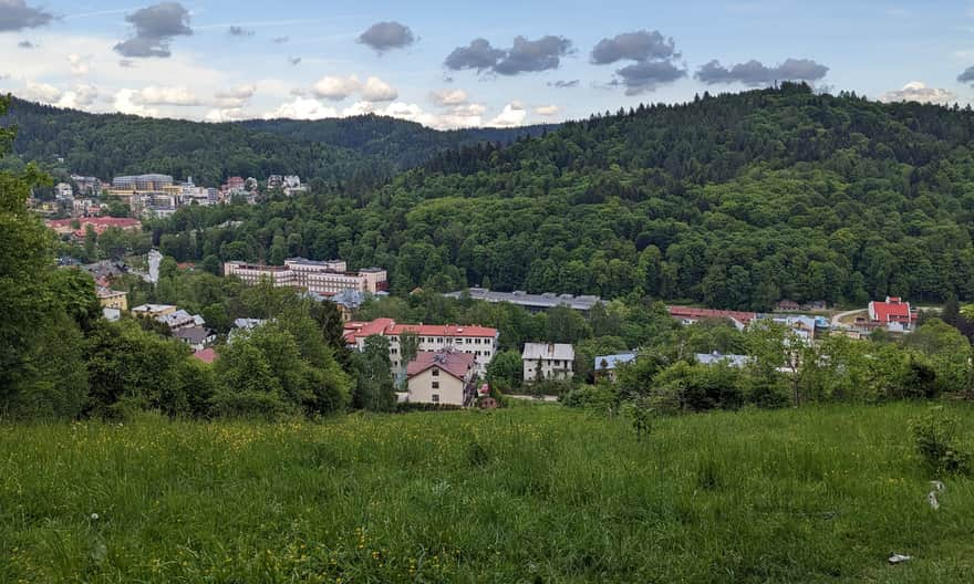
Before the main climb, it's worth stopping at the viewpoint overlooking Krynica and Góra Parkowa. The next viewpoint is on Góra Krzyżowa!
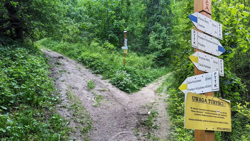
Split of the yellow and blue trails near Góra Krzyżowa
The blue and yellow trails split just below the summit of Góra Krzyżowa: the blue trail turns right and crosses a ski slope (this passage is closed in winter!). The yellow trail climbs to the very top, to the upper station of the Henryk chairlift and to the cross that gives the mountain its name.
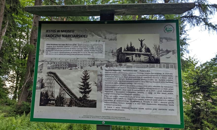
Site of the former ski jump
The yellow trail climbs to the summit, but before reaching it, it's worth taking a side path to see information about the former ski jump. Now it's clear why the slope we're climbing is so steep!
Fortunately, the steep climb is not long, and after about 20 minutes, we reach the ridge (the path flattens out), and after another 5-10 minutes, we reach the summit of Góra Krzyżowa!
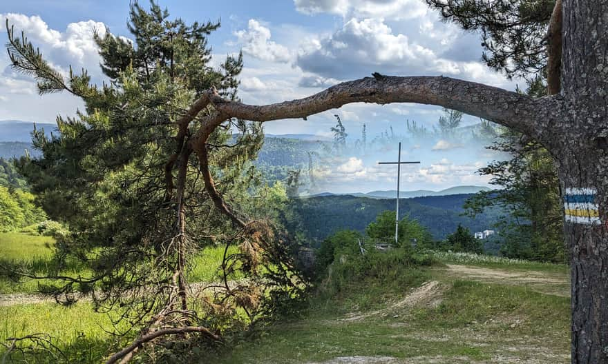
Góra Krzyżowa, 812 meters above sea level
The summit may not be very prominent, but it offers a nice view of Krynica-Zdrój, the surrounding hills, and the green ridges of the Low Beskids.
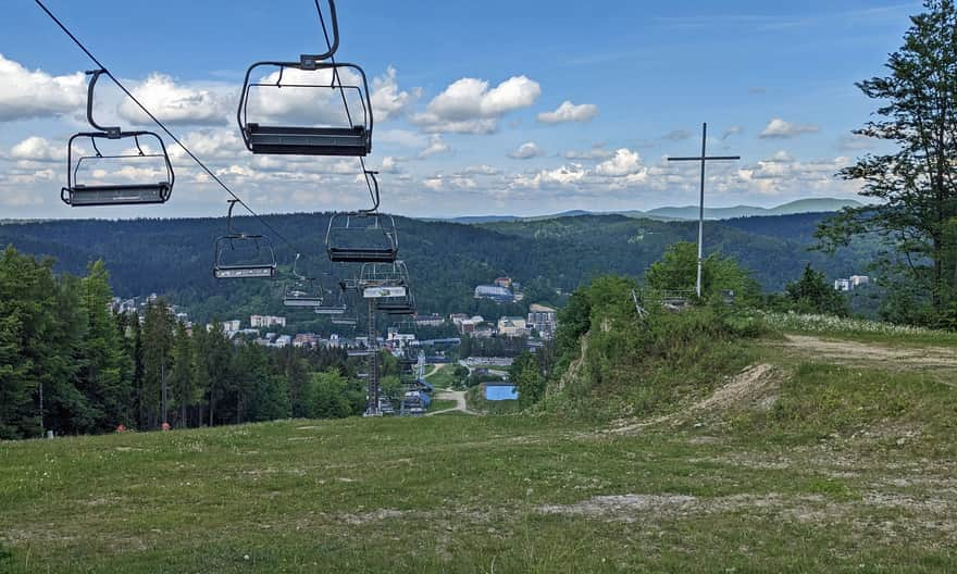
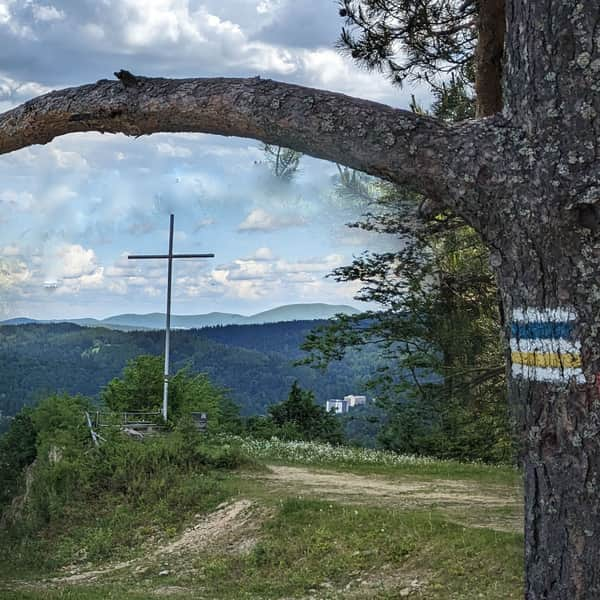
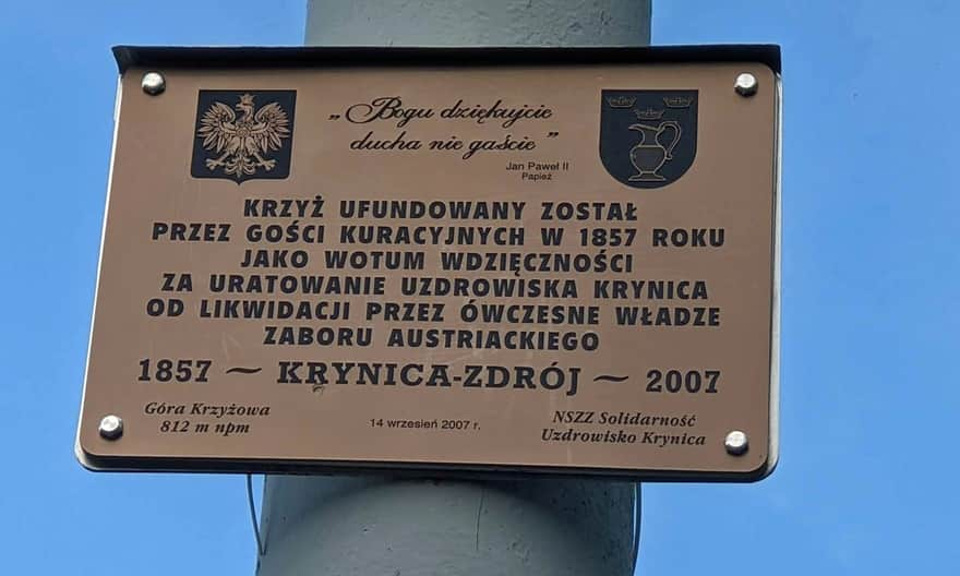
Why is there a cross on Góra Krzyżowa?
A plaque at the cross explains that...
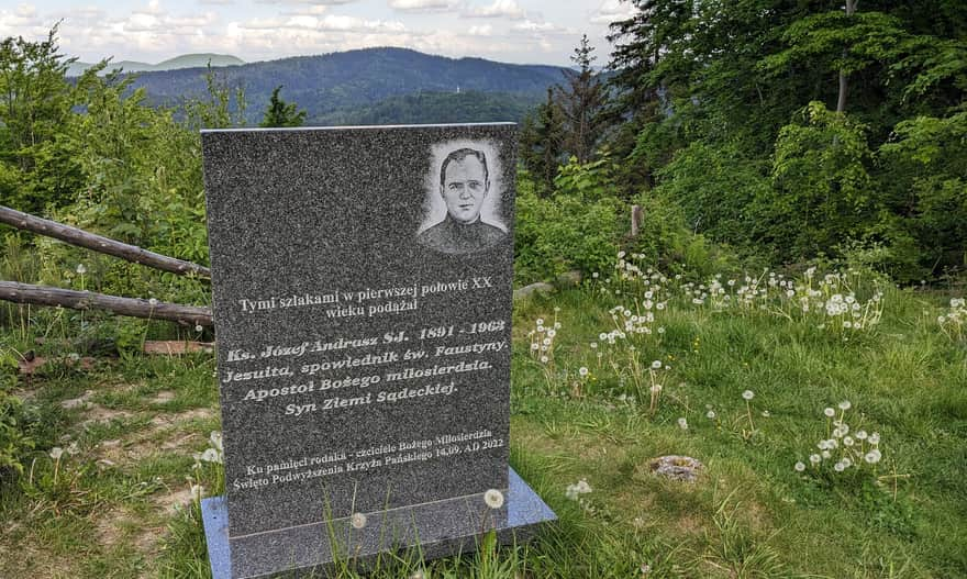
There is also a commemorative plaque (unrelated to the cross) at the summit.
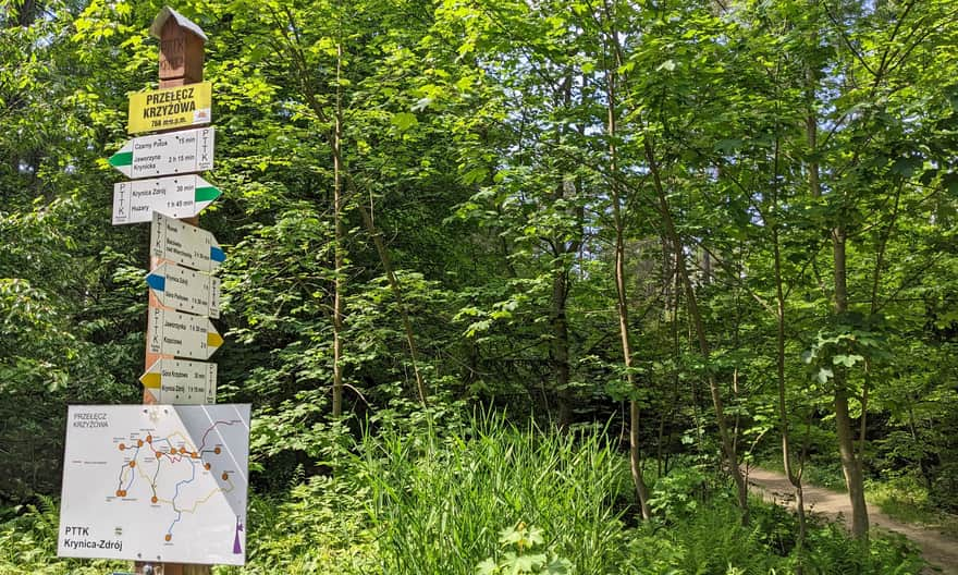
From Góra Krzyżowa, we descend a comfortable forest path to the junction with the blue and also the green trail. These trails soon split again at Przełęcz Krzyżowa.
From here, the green trail descends to Czarny Potok, then climbs along the ski slope to the PTTK shelter on Jaworzyna Krynicka, and then to the summit of this majestic mountain.
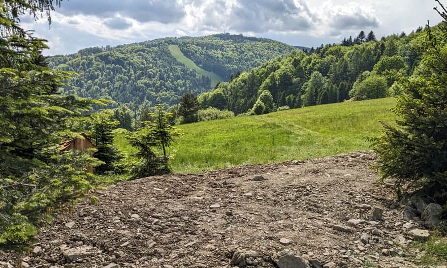
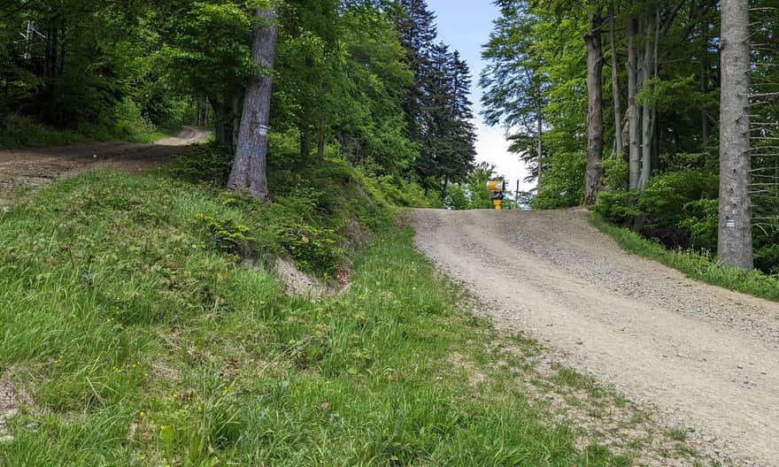
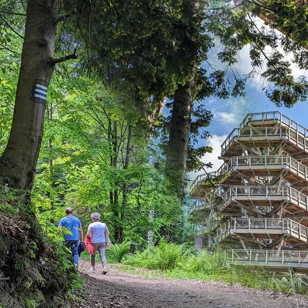
Ascent to the Słotwiny tower
From Przełęcz Krzyżowa to the Słotwiny tower, it takes about half an hour. It's uphill again, but the elevation gain is only 100 meters. So, the path is easy and pleasant, still through the forest.
Along the way, we come across scenic clearings: first, when we reach the access road from Słotwiny to the northeast, including Lackowa.
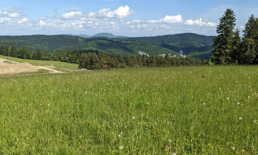
...and then to the southeast, including the majestic summit of Jaworzyna Krynicka (the one with the mast, cable car, and ski slope).
* Look: this is what the clearing we're on looks like and our hiking goal: the observation tower 'from the other side,' that is, from the slopes of Jaworzyna Krynicka.

At this point, just below the tower, we can choose any path: both will lead us to our destination (the one on the left is a hiking trail, and the one on the right is an access road).
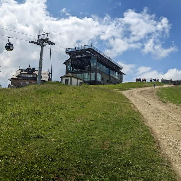
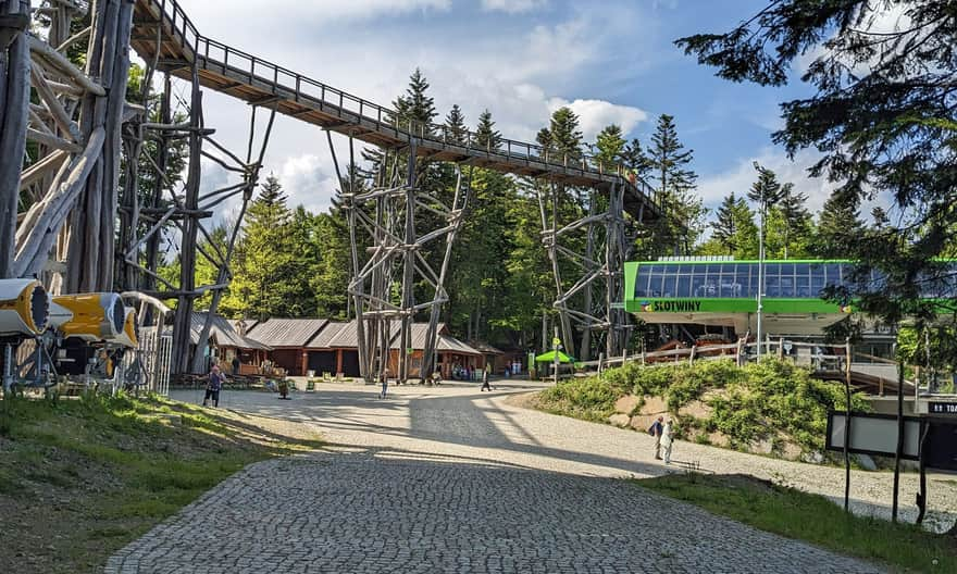
Słotwiny - observation tower, tree-top walk, and other attractions
Just a bit more through the forest, and we're there: here's the upper station of the chairlift, the observation tower, the tree-top walk, as well as a brine graduation tower, food stalls, and restrooms.
Read more about the attractions of this place here:
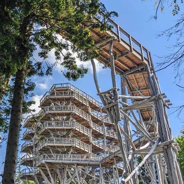
Słotwiny Observation Tower in Krynica Zdrój
The observation tower in Krynica-Zdrój is a wooden structure reinforced with steel at the top of the Słotwiny Arena ski resort. ...
Return from Słotwiny to Krynica-Zdrój
From the observation tower, we can take the chairlift back to Krynica Słotwiny or walk back the same way we came (the descent back to the promenade takes about 1.5 hours).
For a change, we can also choose the green trail, which descends to Marszałka J. Piłsudskiego Street and Nitribitta Park in about 1 hour and 20 minutes.
Medium
Green trail to Słotwiny tower on Drabiakówka


Publish Date: