The Easiest Trail to Giewont - Blue Trail from Kuźnice through Hala Kondratowa
Nearby: Zakopane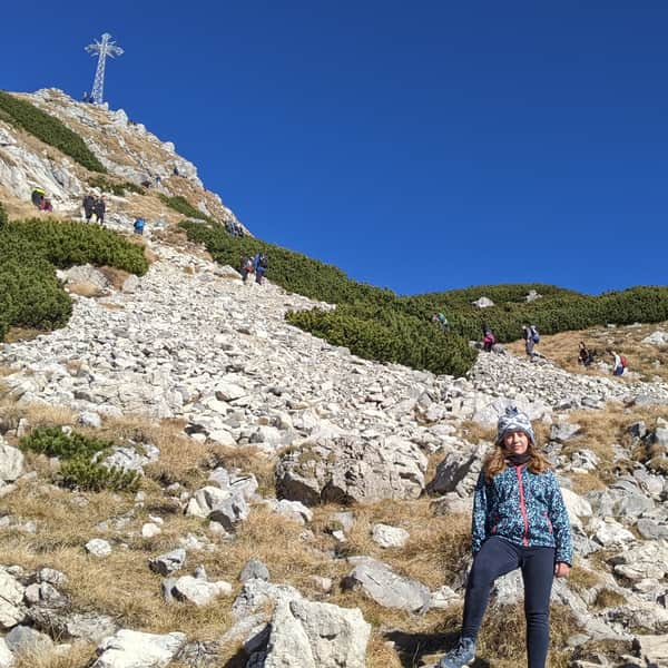
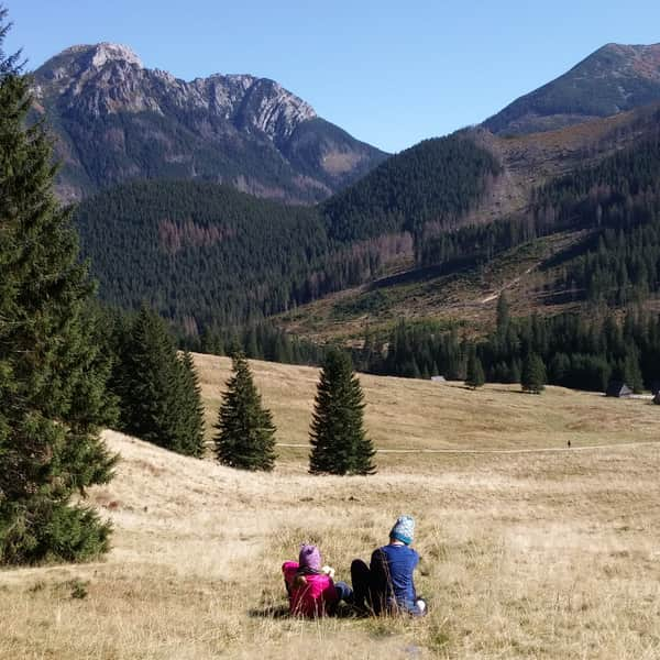
With a Child to Giewont
The blue trail from Kuźnice through Hala Kondratowa is the shortest and easiest way to climb the most famous mountain in the Polish Tatra Mountains! From Zakopane, the mountain looks steep and scary - it's worth seeing its gentler side from the other direction! Although the Giewont massif is not particularly high (1894 m above sea level), reaching the summit is not easy due to its rocky nature.
- The trail to the Giewont Pass is not technically difficult, it just requires good fitness - at the scenic pass, we can decide if we want to reach the summit.
- The approach to the Giewont summit is rocky and has chains - it all depends on the child's individual fitness and fear of heights, the rocks on this part of the trail are very slippery...

Blue Trail from Kuźnice to Giewont - Access, Parking
We start the trail in Kuźnice, at the lower station of the cable car to Kasprowy Wierch. Kuźnice is about 5 km from the center of Zakopane. You can get here from Zakopane by bus, city bus, or car. There are several paid parking lots in Kuźnice.
We follow the blue trail towards Polana Kalatówki and Hala Kondratowa.

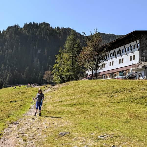
Polana Kalatówki
This is the first stop on our route. A picturesque clearing with a view of Nosal and the cable car line to Kasprowy Wierch. You can see the cable cars passing by from time to time. Sheep grazing is conducted on Polana Kalatówki. There is a mountain hotel and a restaurant here.
Easy
Kalatówki Meadow


Hala Kondratowa and Shelter on Hala Kondratowa
We continue climbing to the shelter on Hala Kondratowa. This part of the trail runs mainly through the forest, and the path's slope is still quite gentle. Hala Kondratowa is an ideal place to rest before the more difficult part of the trail.


Approach to Kondracka Pass
After Hala Kondratowa, the approach becomes more challenging - the rocky path climbs steeply uphill. This part of the trail is exposed, which is as scenic as it is uncomfortable for those with a fear of heights. But don't worry - the path to Kondracka Pass is still quite safe.


Kondracka Pass (1725 m above sea level)
This is the pass between Kondracka Kopa and Giewont - the last place to rest before reaching the summit. We have climbed very high, so it's definitely worth taking a moment to catch our breath - the view includes Kasprowy Wierch and the wrinkled noses of Nosal.


Approach to Giewont Summit
This is undoubtedly a moment of tough decisions: the trail leading to the Giewont summit is one-way - there's no turning back, you can't change your mind and go back. Once you start the trail, you reach the summit and descend another way down to Kondracka Pass. It's hard to give any advice here, everything is very individual - what is an exciting challenge for some may be terrifying for others, regardless of age. The situation is not helped by the line of people behind you aiming to reach the summit - after all, it's the most popular mountain in the Polish Tatras.


Giewont (1894 m above sea level)
We did it, we climbed to the very nose of the sleeping knight, or rather his mustache? From the top, there is a view of the city of Zakopane lying at its feet. The most popular mountain in the Polish Tatras checked off!


Publish Date:
More in the Region Zakopane (Zakopane)