Równia: Church and trail to the tower on Holicy
Nearby: Ustrzyki Dolne| Distance | 5.3km |
|---|---|
| Time | 2h 4min |
| Ascents | 301m |
| Descents | 63m |
beach_access Route in the shade
directions_car Access by car
directions_bus Can be reached by bus
wc Toilet along the route
The blue trail from Równica to the Żuków range and to the new tower on Holicy combines several attractions: visiting a historic wooden church, a forest walk, and beautiful panoramas from the viewing tower's terrace.
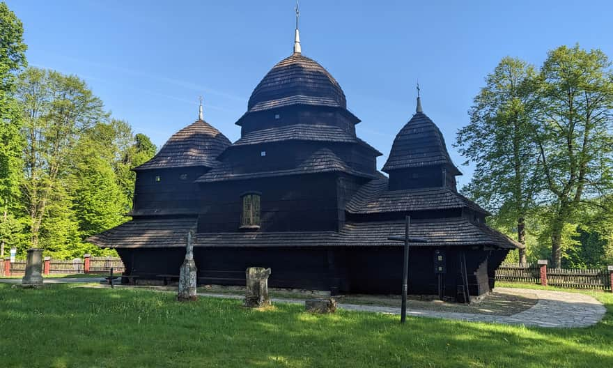
Historic wooden Boyko church in Równia
The best way to start your hike from the town of Równia to the viewing tower on Holicy is by visiting the historic Boyko church (there is also a small free parking lot here). The wooden temple dates back to the 18th century. Unfortunately, nothing but the walls and a few tombstones have survived from the times when it served the local Greek Catholic population. The preserved elements of the church's equipment, dedicated to the Protection of the Mother of God in Równia (a few icons), are now in the museum in Łańcut.
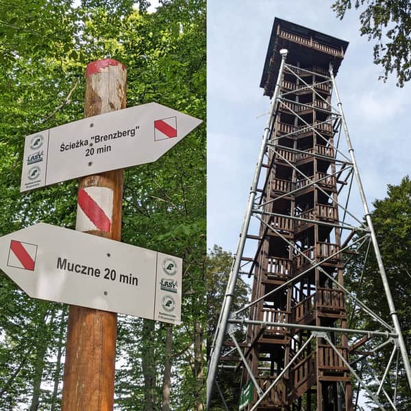
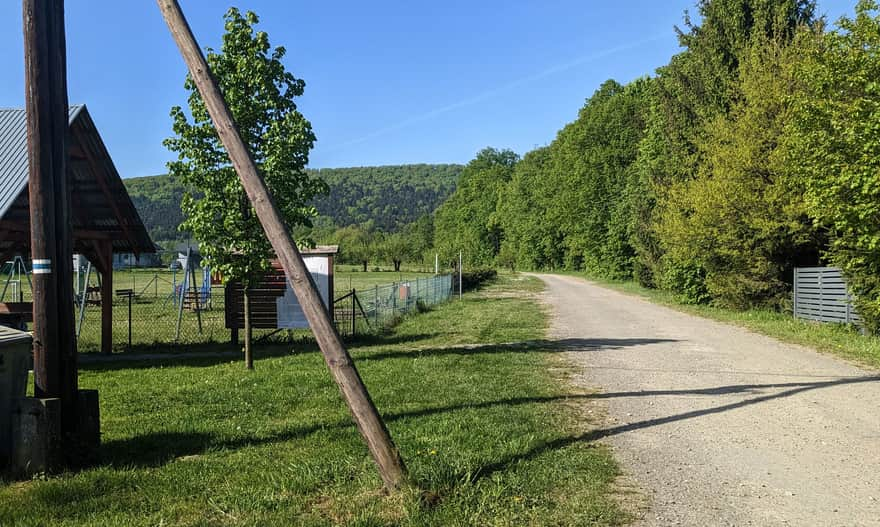
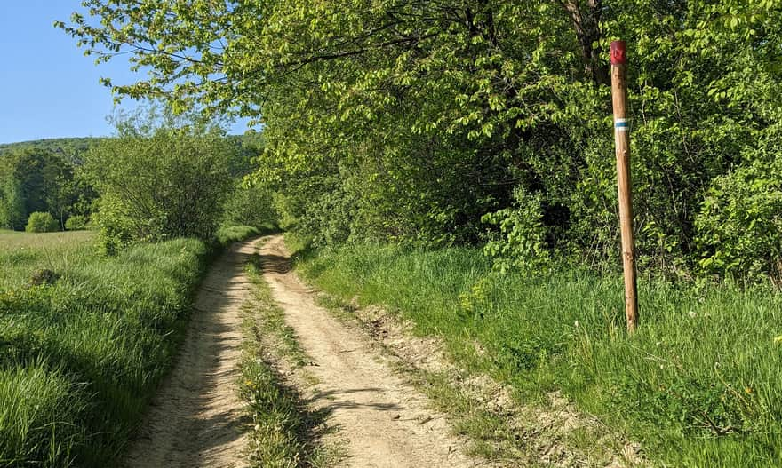
Start of the blue trail in Równia
The blue trail cuts through the center of Równia and heads south along a wide and comfortable beaten path. Right next to it, you will find a shelter and a small playground.
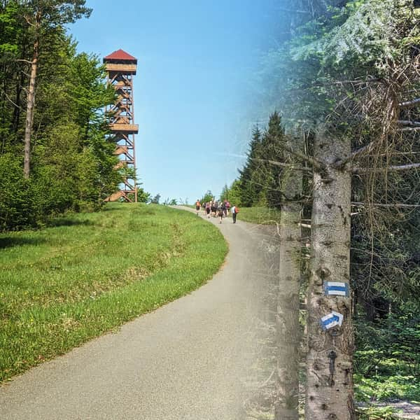
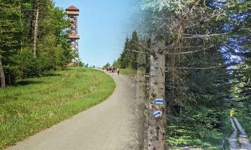
Blue trail Równia - Żuków - viewing tower on Holicy
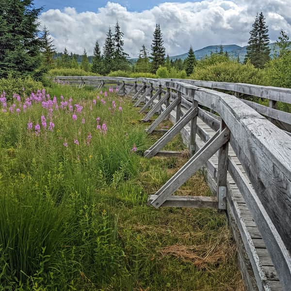
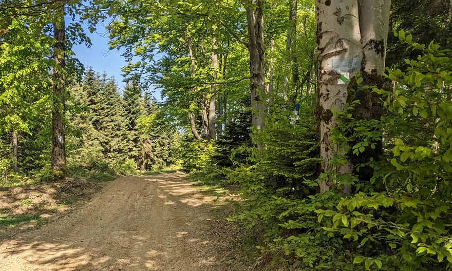
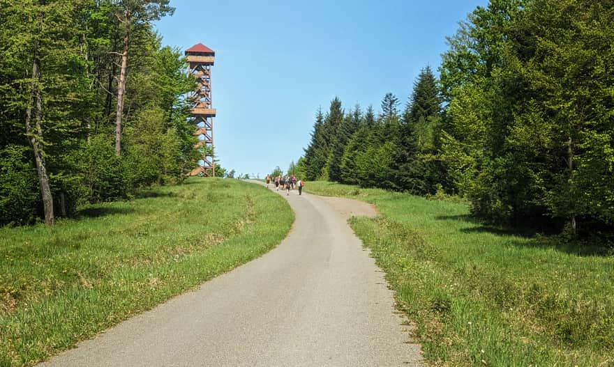
Most of the blue trail from Równia towards the viewing tower on Holicy is a forest road that slowly ascends towards the ridge of Żuków. Only after turning off the educational path does it start to get steep. Fortunately, this is not a very long section and after about 20-30 minutes of climbing, we can continue to walk at a leisurely pace.
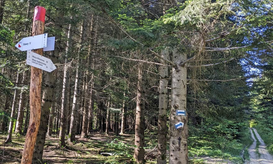
Żuków - ridge walk towards
After reaching the ridge of Żuków, we turn right along with the blue signs.
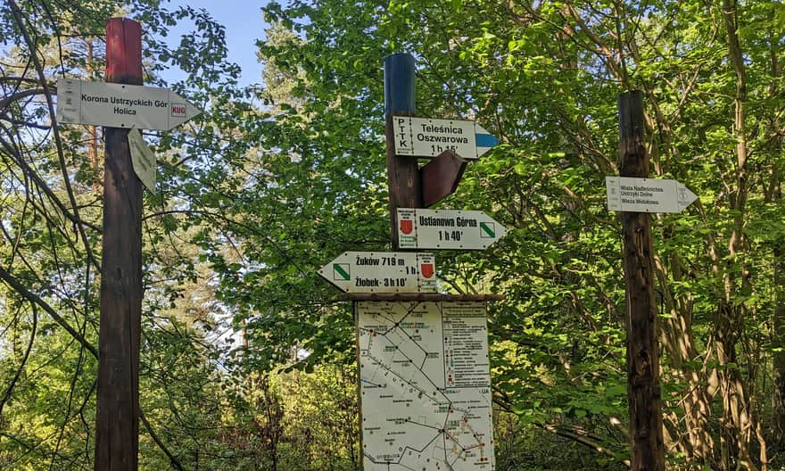
A wide beaten path leads us through the forest. After about 15 minutes, the blue trail descends to the left towards Daszówka and Teleśnica Oszwarowa. However, to reach the tower, we continue straight - this time not on a forest, but on a hardened gravel-asphalt road. The destination of our route is already in sight!
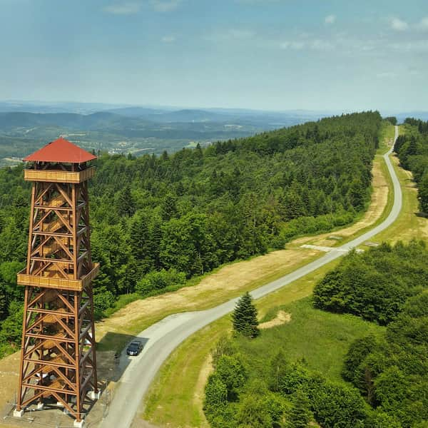
From the tower, it's worth walking about 500 m further to a campsite, i.e., a vast meadow with a viewpoint, a shelter, numerous benches, tables, a place for a bonfire, information boards about the gliding site, and nature puzzles for children. You can also use the toilet here.

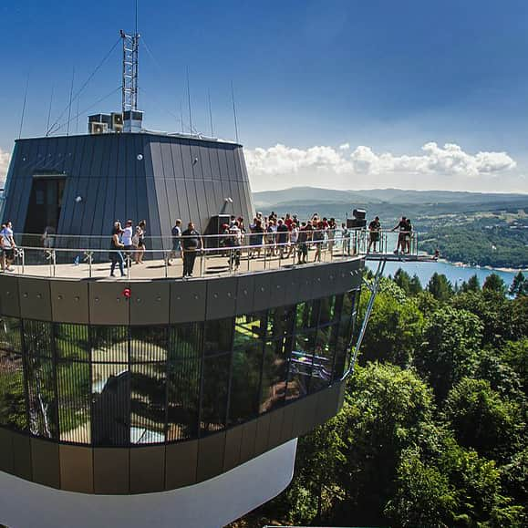
More about the viewing tower, what we will see from the top, the history of the gliding site, and other routes leading here, we write here:
Tower on Holica: How to Get There and What Can We See from the Top?
The viewing tower on Holica (761 meters above sea level) in the Żuków Range near Ustrzyki Dolne is one of the newest attractions in the region. From the top terrace of the tower, you can enjoy a wonderful view of the surrounding area, including the Sanocko-Turczańskie Mountains and the Bieszczady: Tarnica and Halicz Nest, Caryńska, Wetlińska, and Wielka Rawka. ...

More in the Region Bieszczady (Bieszczady)