Recommended Scenic Trail to Tarnica - Red Trail from Ustrzyki Górne
Nearby: Ustrzyki Dolne| Distance | 7.1km |
|---|---|
| Time | 3h 32min |
| Ascents | 706m |
| Descents | 55m |
wb_sunny Route in the sun
directions_car Access by car
directions_bus Can be reached by bus
warning No dogs allowed
The red trail from Ustrzyki Górne to Tarnica (1346 meters above sea level) is not the shortest, but it is the most convenient and offers great views, making it the best route to the highest peak of the Polish Bieszczady Mountains.
- Why choose the red trail from Ustrzyki when going to Tarnica?
- Starting point of the red trail to Tarnica in Ustrzyki Górne - parking
- Nature trail Ustrzyki Górne - Szeroki Wierch
- Red trail Ustrzyki Górne - Szeroki Wierch - Tarnica
- Shelter on the red trail from Ustrzyki Górne to Tarnica
- Hiking along the ridge of Szeroki Wierch
- Pass under Tarnica

Why choose the red trail from Ustrzyki when going to Tarnica?
- Easy access and a large parking area (paid)
- The elevation gain is spread out over a longer distance, making the climb less exhausting. There are many flat sections along the way!
- Almost half of the trail is a scenic walk along the ridge of Szeroki Wierch, offering beautiful panoramas.
- The tourist traffic is much lower here compared to the shortest (and crowded during the season) blue trail from Wołosate.
- There are stops along the nature trail that help us keep track of how much further we have to go.

Starting point of the red trail to Tarnica in Ustrzyki Górne - parking
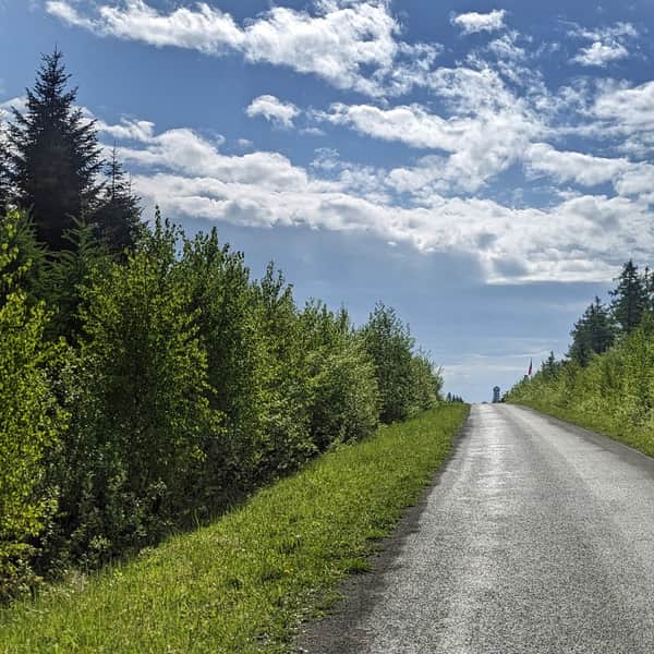
The red trail (also known as the Main Beskid Trail) passes through the center of Ustrzyki Górne. You can reach it by bus or minibus. If you choose to go by car, there are several large paid parking lots available. Displays at the entrance of the town indicate the availability of free spaces. You can leave your car by the main road or drive all the way to the border of the Bieszczady National Park (saving yourself about 1 km of walking on asphalt).
At the beginning of our route, there is a ticket office for the Bieszczady National Park, where you can purchase tickets and souvenirs (buying tickets is mandatory!). There are also toilets available. A food truck operates here seasonally.

Nature trail Ustrzyki Górne - Szeroki Wierch
As you may notice, our blue trail is accompanied by an educational nature trail called "Ustrzyki Górne - Szeroki Wierch." The stops are marked with numbers from 1 to 26, making it easier, among other things, to answer the question "how much further?" especially for the youngest hikers.

Of course, it is also worth exploring what each stop refers to. At the ticket office, you can get a brochure with more detailed descriptions of the stops.
Red trail Ustrzyki Górne - Szeroki Wierch - Tarnica
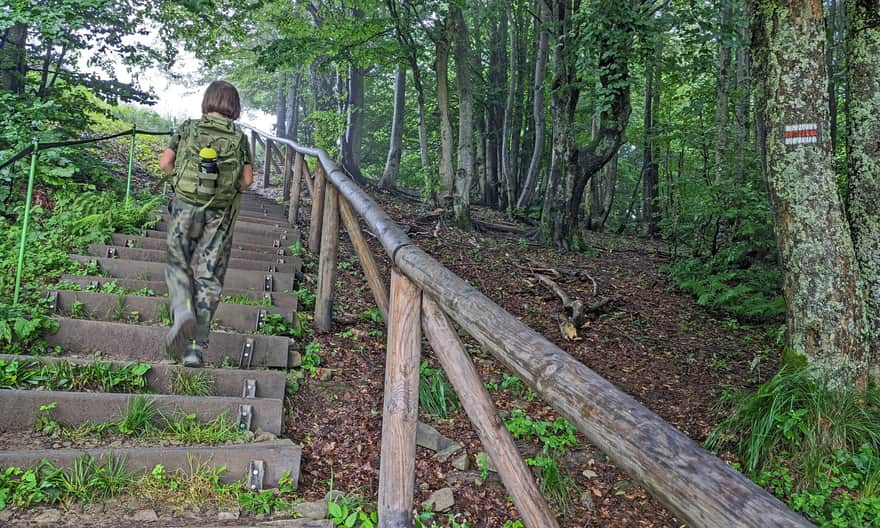
The beginning of our route is a pleasant walk along the Terebowiec stream valley. The climb will start in a beech forest, but it won't be very steep.

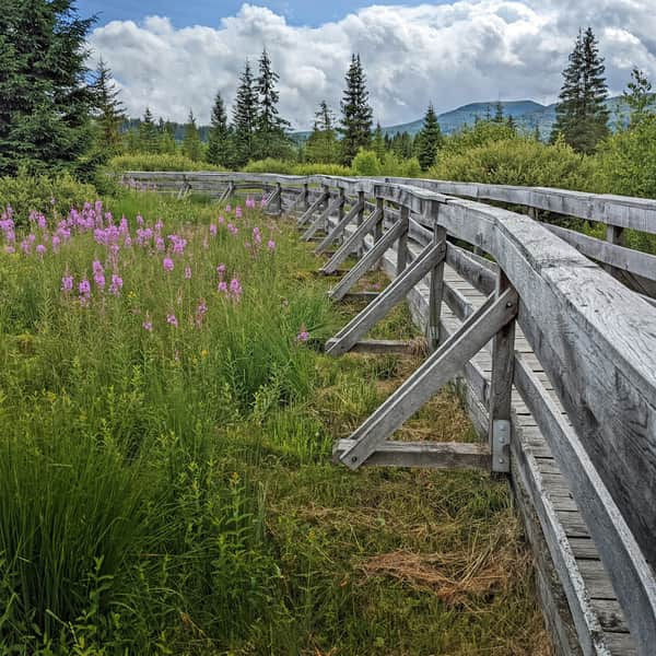
The trail is well-prepared: wooden platforms are placed in areas where water (and mud) could accumulate, and wooden stairs are built on steep sections.
Shelter on the red trail from Ustrzyki Górne to Tarnica
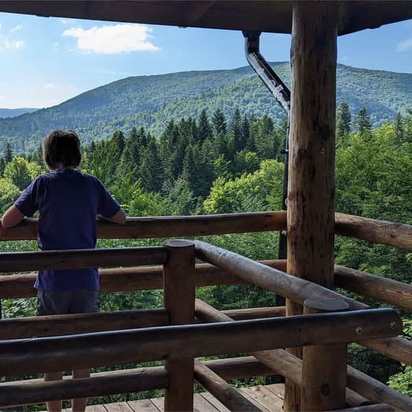
After less than an hour from passing the ticket office, we will reach a large shelter with a roof. Here, you can rest and regain strength before continuing the hike.

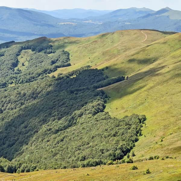
Hiking along the ridge of Szeroki Wierch
After about half an hour from resting at the shelter, we will reach the edge of the forest, from where we climb up the grassy ridge of Szeroki Wierch.
Ahead of us is the most enjoyable section of the trail: approximately 3 km of scenic walking! Of course, this is provided that the weather is favorable... And even if not, the mists will add a magical atmosphere to our hike.


Pass under Tarnica
After about 3 hours from starting the trail, we will reach the summit of Tarniczka, from where we descend to the intersection of all paths leading to Tarnica, known as the Pass under Tarnica.

From here, we continue climbing: a short yellow trail will take us to the summit, which we should reach in about 15 minutes from the pass.

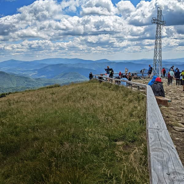
Tarnica 1346 meters above sea level - summit and views
Congratulations! You have reached the highest peak of the Polish Bieszczady Mountains! On a clear day, you will be rewarded with magnificent views in all directions!

What can you see from the summit of Tarnica? How did the peak get its name and the large metal cross? We write about everything worth knowing about Tarnica in this article:
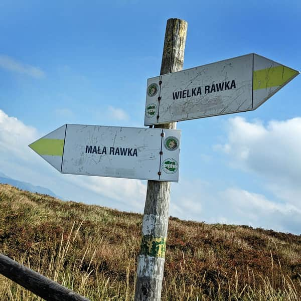
All roads and trails to Tarnica
Tarnica (1346 meters above sea level) is the highest peak of the Polish Bieszczady Mountains. It is famous for its beautiful views... and the queue to take a photo "with the cross." Discover interesting facts about the Tarnica summit and all the roads, trails, and loops to Tarnica! ...
...and back to Ustrzyki Górne
You can return to Ustrzyki Górne from Tarnica using the same trail (the descent will take about 2 hours). In case of bad weather, it is better to descend quickly from exposed areas to the forest, choosing the shorter blue trail, which will lead you down steeply to Wołosate in about 1 hour. From there, a comfortable asphalt road (6 km) will take you back to Ustrzyki Górne.


Publish Date:
More in the Region Bieszczady (Bieszczady)