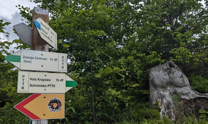
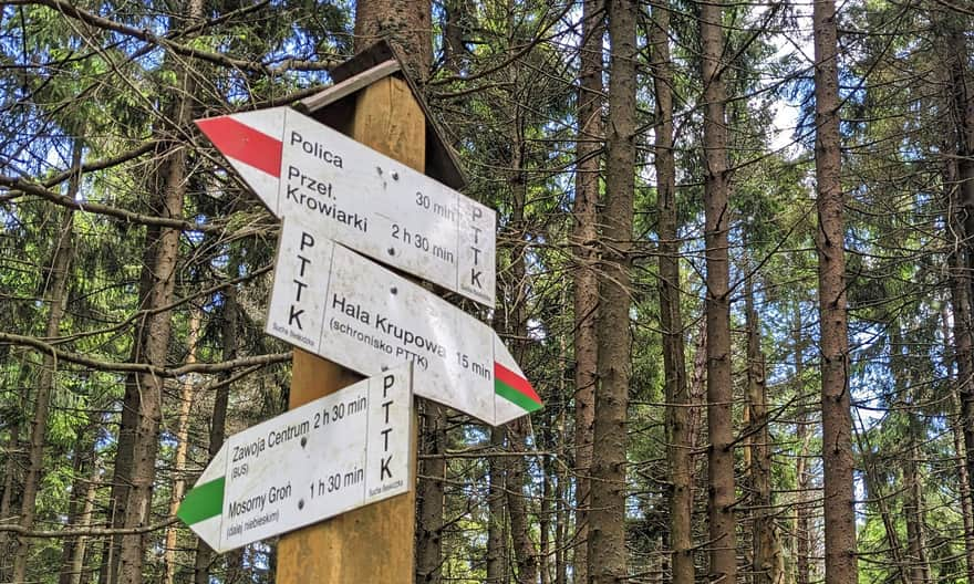
Mosorny Groń - PTTK Shelter on Hala Krupowa: blue and green trail
Nearby: Sucha Beskidzkarestaurant Restaurant or bar nearby
wc Toilet along the route
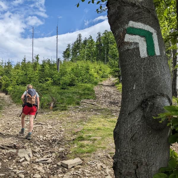
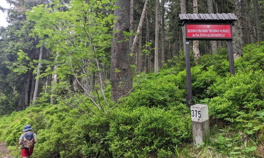
The green trail from Hala Krupowa towards Mosorny Groń goes along the edge of the "Na Policy im. Z. Klemensiewicza" reserve. It bypasses the peaks of Polica and Cyl Hali Śmietanowej, but offers different views: to the north of the Polica Range. It's a good alternative to the red and yellow trails, especially if you want to make a loop around Polica starting from Hala Krupowa or Mosorny Groń.
How to get to Mosorny Groń?
The easiest way is by taking the year-round chairlift from Zawoja Lajkonik. You can also hike up one of the trails. At the top, be sure to visit the viewing tower. For more information on what to see at the top and how to get there, read here:
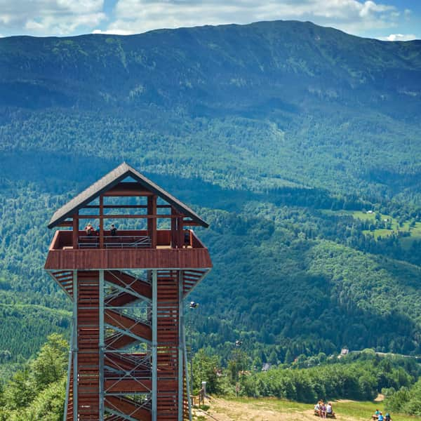
Mosorny Groń - observation tower, trails, attractions
Mosorny Groń (1047 meters above sea level) is a peak in the Polic Range, at the foot of Babia Góra. The new observation tower offers beautiful panoramas of the surrounding ranges: Babia Góra, Polic Range, Jałowiec Range. On a clear day, you can even see the Tatra Mountains! ...
Getting to the green trail from Mosorny Groń
From the top of Mosorny Groń, follow the yellow trail towards Cyl Hali Śmietanowej. After a few dozen meters, the blue trail from Zawoja Mosorne joins in - don't turn yet! Only when the blue trail turns left for the second time, leave the yellow trail.
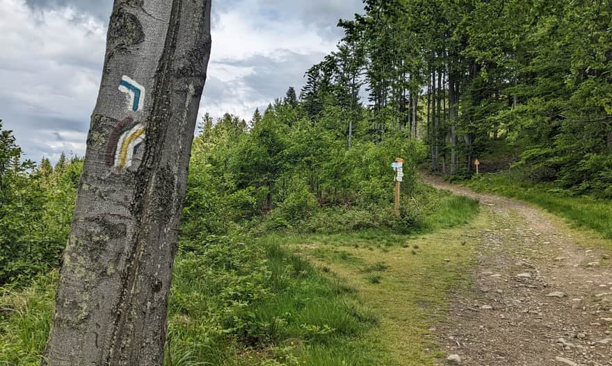
Blue trail to the green trail to Hala Krupowa
After about 15 minutes of descending a forest path, the blue trail ends at the green trail. Turn right here - uphill.
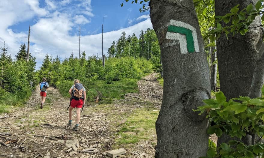
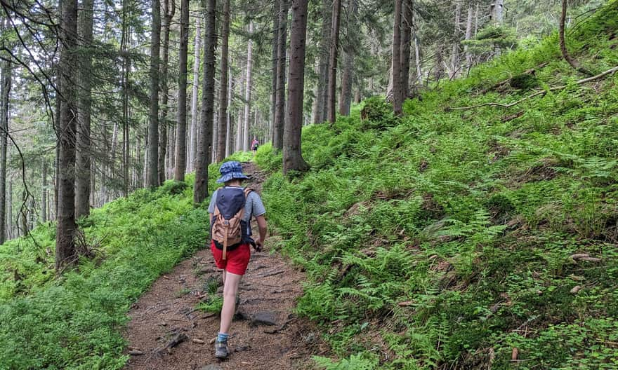
Green trail through the "Na Policy im. Prof. Z. Klemensiewicza" Reserve
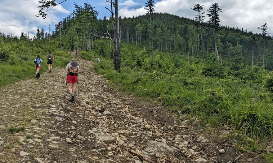
Initially, the green markers lead us along a wide forest road on the northern slopes of Cyl Hali Śmietanowej. Although we only traverse the slopes without reaching the summit, we still climb uphill. However, these climbs are not as steep as on the yellow trail!
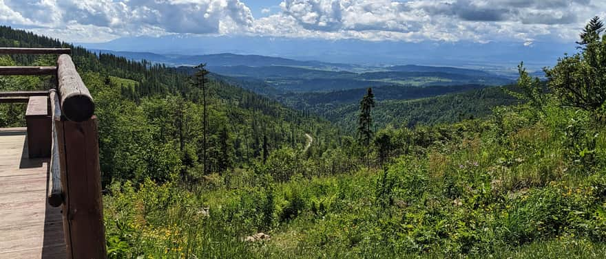
Views from the green trail
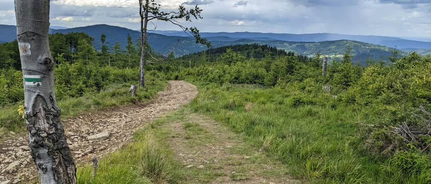
Another difference between the yellow and green trails is the views. The yellow trail is steep and forested. On the green trail, you can enjoy wide panoramas of the Jałowieckie Range, Beskid Mały, and Makowski (northeast).
After reaching the reserve, the forest surrounds us, and the path becomes narrow and wild. However, we will be walking on relatively flat terrain, bypassing the main peak of Polica.
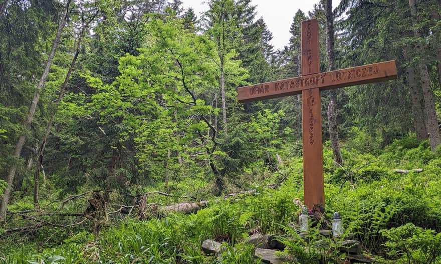
Memorial site for the victims of the plane crash on Polica
After entering the reserve, you will see this cross by the path. It marks the spot where, on April 2, 1969, a passenger plane flying from Warsaw to Krakow crashed into the slopes of Polica (above, at the very top of Polica, there is a larger monument with a list of the victims of this crash).
Green trail to Hala Krupowa
About 2 hours after leaving the top of Mosorny Groń, we reach the ridge red trail.
Now, together with the red trail, in about 15 minutes we will reach the scenic Kucałowa Pass, at the foot of which is the PTTK shelter on Hala Krupowa.
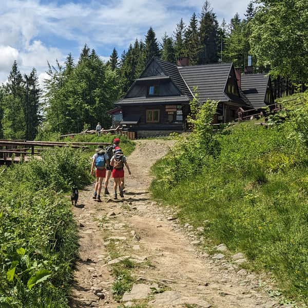
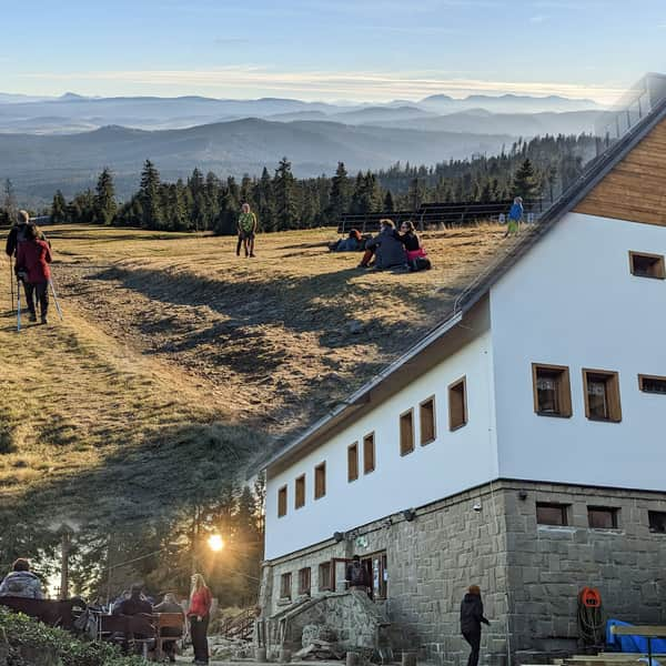
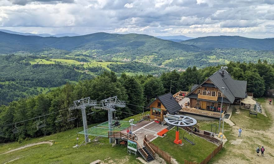
The PTTK Shelter on Hala Krupowa - trails, views, curiosities
The PTTK Shelter on Hala Krupowa is a picturesque and scenic place in the Żywiec Beskids, near the summit of Policy (1369 meters above sea level). It can be a destination for a mountain trip or a stop during a longer hike through the Polic Range. ...
Loop around the peak of Polica
The green trail is not as attractive as the red one, which goes through the peaks of Polica and Cyl Hali Śmietanowej. However, it's worth considering if you want to return to your starting point by a different route when starting from Mosorny Groń, Hala Krupowa, or Kucałowa Pass.
Due to the steep climb on the yellow trail between Mosorny Groń and Cyl Hali Śmietanowej, we suggest starting from Hala Krupowa, first climbing Polica and Cyl via the red trail, then descending the yellow trail to Mosorny Groń, and finally returning via the green trail. If starting from Mosorny Groń, first take the green trail, and on the way back from Hala Krupowa, climb Polica and Cyl Hali Śmietanowej via the red trail.


Publish Date: