Green trail to Słotwiny tower on Drabiakówka
Nearby: Nowy Sączbeach_access Route in the shade
restaurant Restaurant or bar nearby
directions_bus Can be reached by bus
train Access by train possible
wc Toilet along the route
The green trail from Krynica-Zdrój to Krzyżowa Pass and then following the blue and yellow signs to Drabiakówka is a good idea for an easy and pleasant walk to the Słotwiny observation tower and tree-top path. We will walk almost all the time through the forest, without particularly steep climbs, and there will also be "viewing windows" along the way!
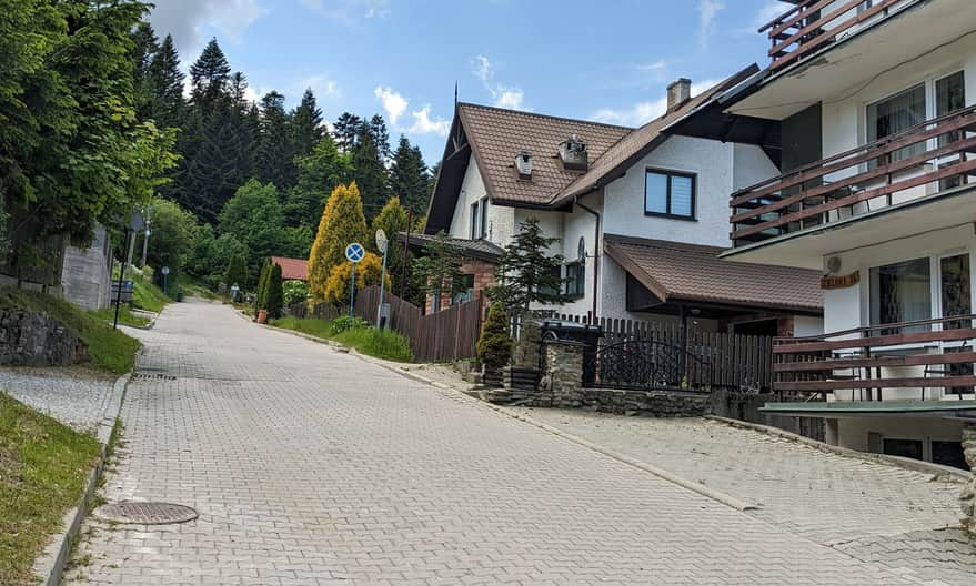
Start of the green trail in Krynica-Zdrój
The green trail crosses Krynica-Zdrój - you will find it both on the main road - Marszałka J. Piłsudskiego Street, and on the neighboring Pułaskiego Street. It leads to Jaworzyna Krynicka and Muszyna Złockie (and in the other direction to Huzary and Dzielec Mountain above Tylicz).
You can start the green trail, for example, from the area around Nitribitta Park, where there are several parking lots (unfortunately paid). You can also park a bit higher, on Dąbrowskiego and Zielona Streets - for example, near the Henryk ski lift.
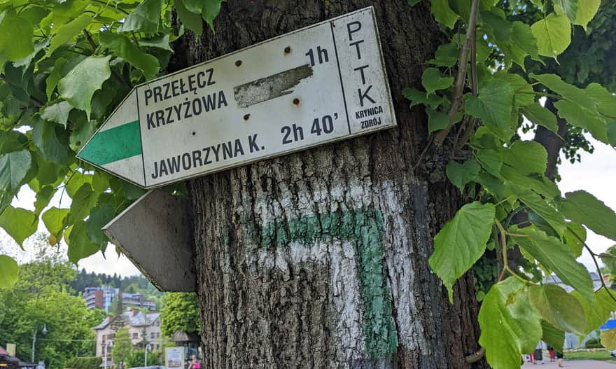
Green trail from Krynica-Zdrój to Krzyżowa Pass
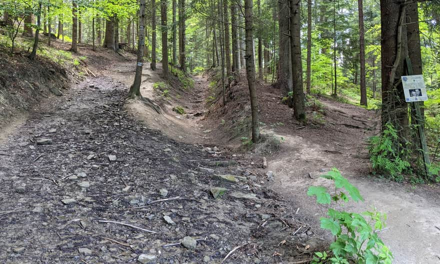
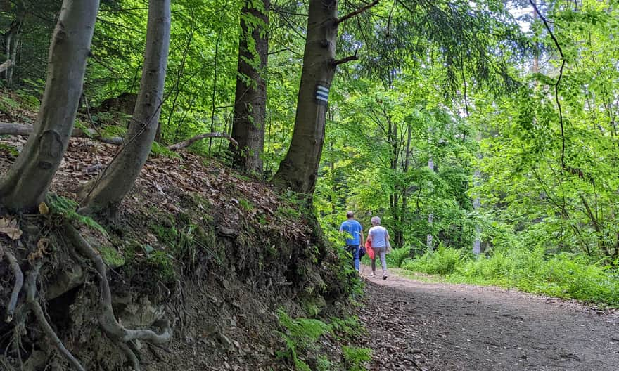
The first section is a climb up the sidewalk on the quiet Zielona Street. About 20 minutes after leaving Nitribitta Park, we enter the forest. It will be uphill here too, but not too steep. The path is wide and comfortable.
Additional attractions on the trail
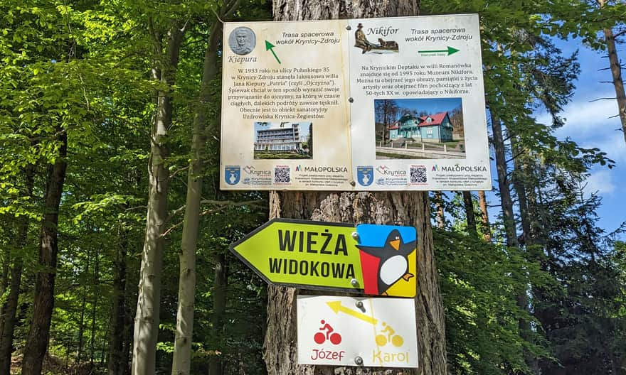
Just like other paths and trails around Krynica-Zdrój, along the way, we can find boards with interesting facts about the history of the spa and its famous guests. On our route, we can look for them, among others, right after entering the forest, at the intersection of the green, yellow, and blue trails, and at Krzyżowa Pass.
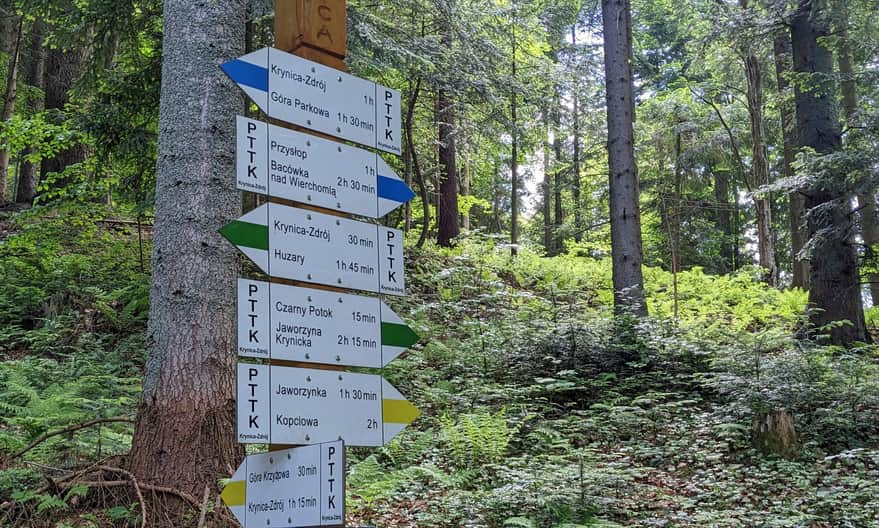
Intersection with the blue and yellow trail
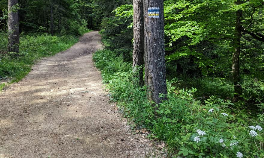
When our green signs join the yellow and blue signs, it means we are already on the ridge, and now we will walk almost on flat ground. It's worth remembering this place: if we want to return to Krynica by a different route, i.e., through Krzyżowa Mountain, we will turn onto another trail here (more about this route at the end of the article).
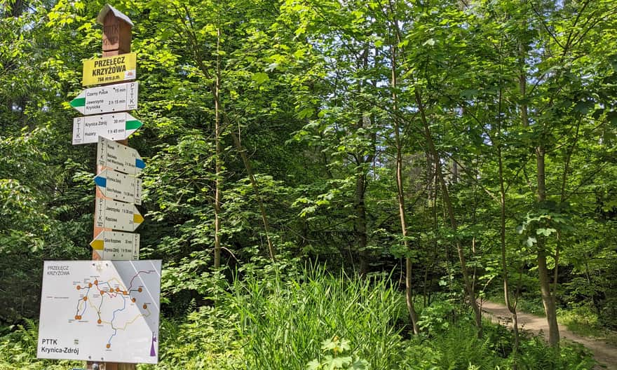
Krzyżowa Pass
At Krzyżowa Pass, we say goodbye to the green signs, which descend from here to Czarny Potok, and then climb along the ski slope to the PTTK shelter on Jaworzyna Krynicka, and then to the very top of this majestic mountain.
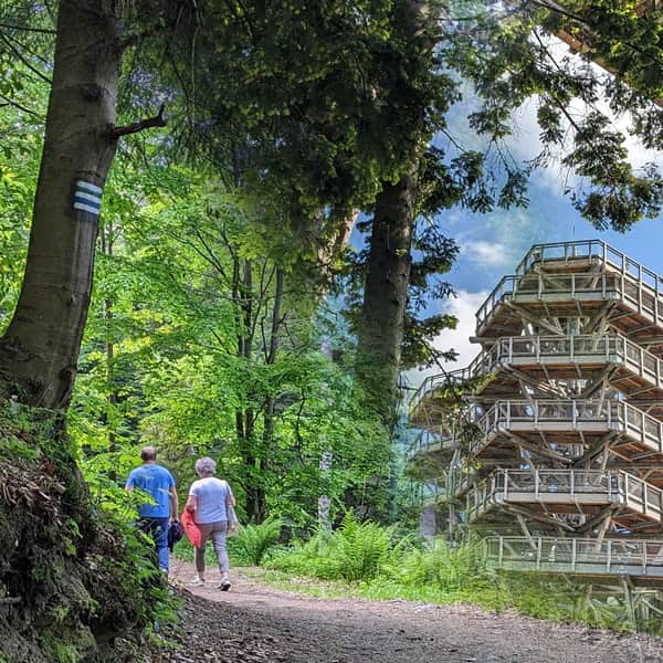
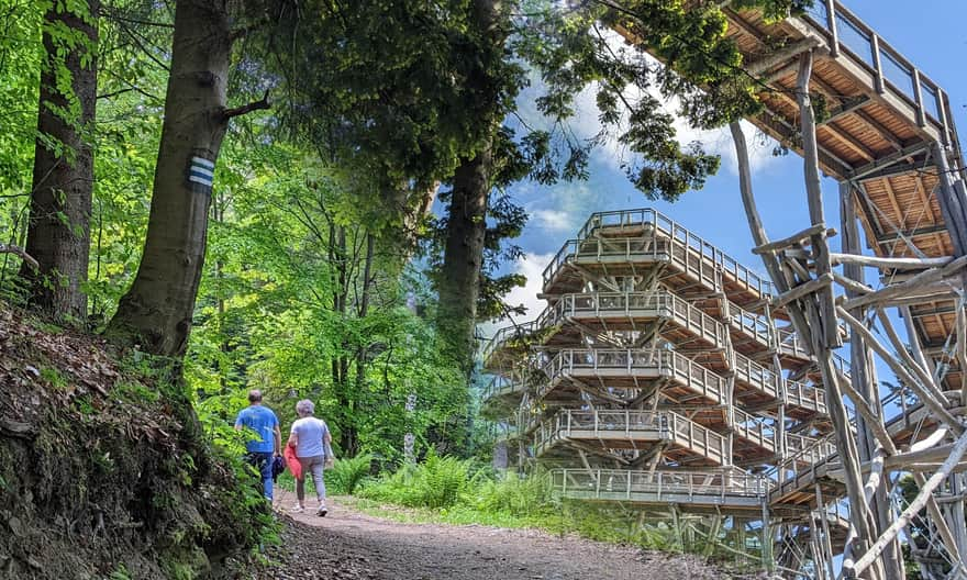
Climb to Słotwiny tower
From Krzyżowa Pass to Słotwiny tower, we have about half an hour left. It will be uphill again, but the height difference to overcome is only 100 meters. So the path is easy and pleasant - still through the forest:
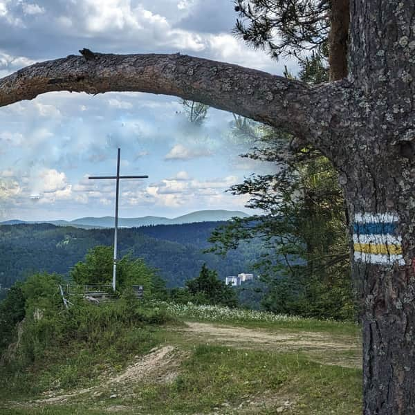
Along the way, we will find scenic clearings: first, when we reach the access road from Słotwiny to the northeast, among others, to Lackowa:
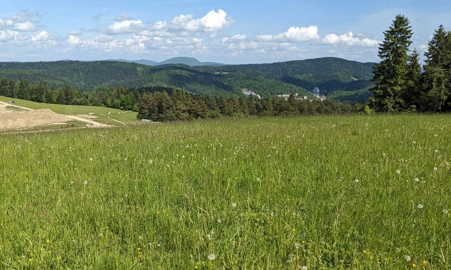
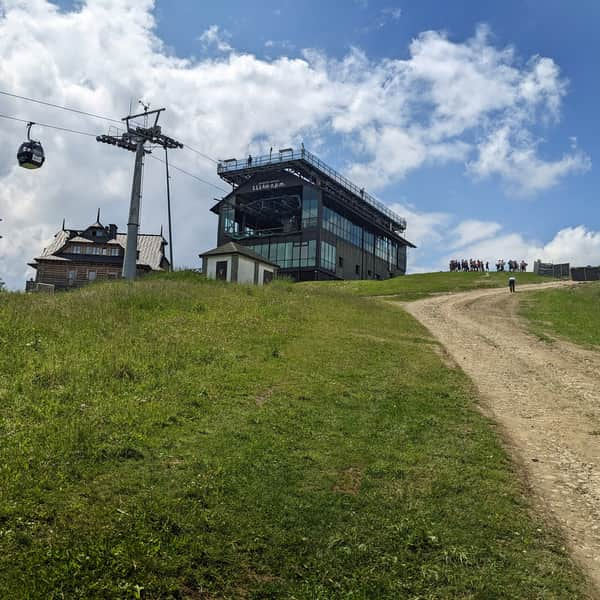
...and then also to the southeast, including the majestic peak of Jaworzyna Krynicka (the one with the mast, cable car, and ski slope):
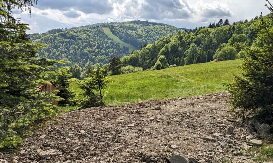
* see: this is what the clearing we are on looks like and our hiking goal: the observation tower "from the other side", i.e., from the slopes of Jaworzyna Krynicka:

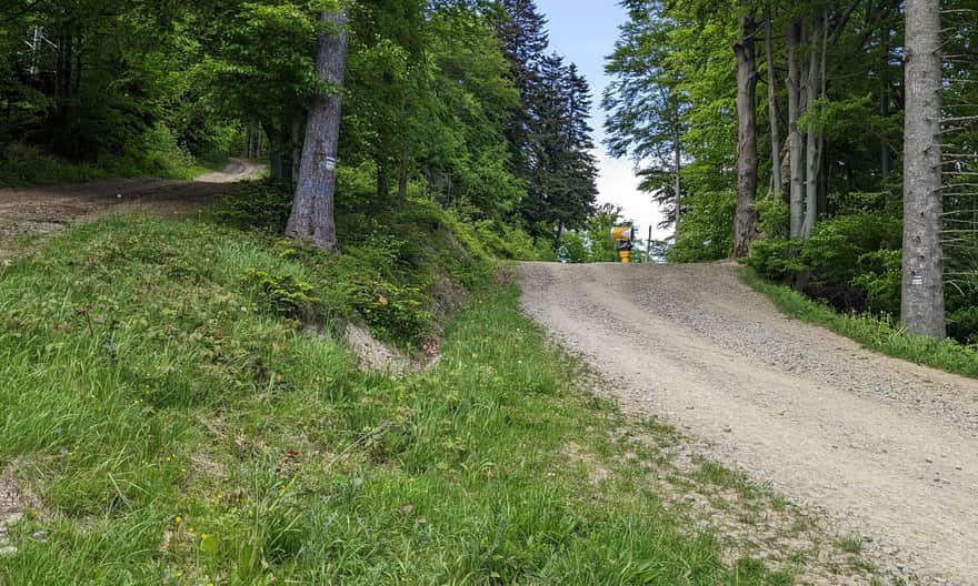
At this point, right under the tower, we can choose any path - both will lead us to the goal (on the left is the hiking trail, on the right - the access road):
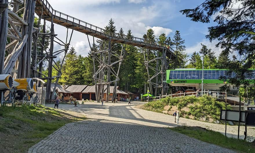
Słotwiny - observation tower, tree-top path, and other attractions
Just a little more through the forest, and we are there: here is the upper station of the cable car, the observation tower, the tree-top path, as well as a brine graduation tower, food points, and the possibility to use the toilet.
More about the attractions of this place can be found here:
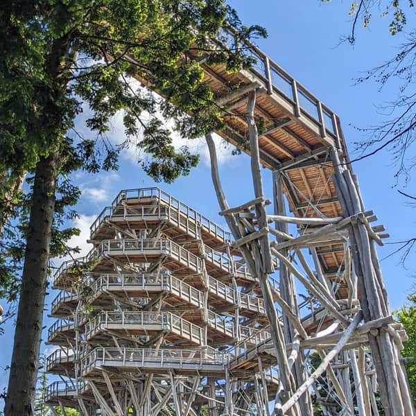
Słotwiny Observation Tower in Krynica Zdrój
The observation tower in Krynica-Zdrój is a wooden structure reinforced with steel at the top of the Słotwiny Arena ski resort. ...
Return from Słotwiny to Krynica-Zdrój
From the observation tower, we can take the cable car down to Krynica Słotwiny or walk back the same way we came (it will take about 1:20 hours to descend to Nitribitta Park). For a change, we can also choose the yellow and blue trail through Krzyżowa Mountain - then in about 1.5 hours, we will descend straight to the main promenade of the spa.
Easy
Yellow and blue trail from Krynica-Zdrój to Góra Krzyżowa and Słotwiny tower