From Zawoja to the Waterfall on Mosorny Stream and Mosorny Groń
Town: Zawoja Nearby: Sucha Beskidzka| Distance | 2.9km |
|---|---|
| Time | 1h 44min |
| Ascents | 408m |
| Descents | 28m |
beach_access Route in the shade
restaurant Restaurant or bar nearby
directions_car Access by car
directions_bus Can be reached by bus
wc Toilet along the route
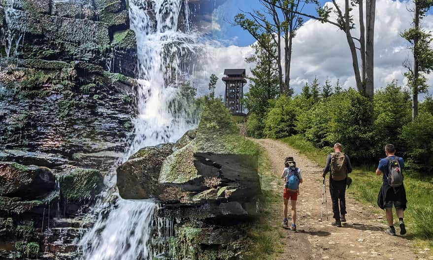
The blue trail from Zawoja Mosorne will take us to a beautiful waterfall on the Mosorny Stream and then to the top of Mosorny Groń (1047 meters above sea level) with a lookout tower, the upper station of a year-round cable car, and a restaurant.
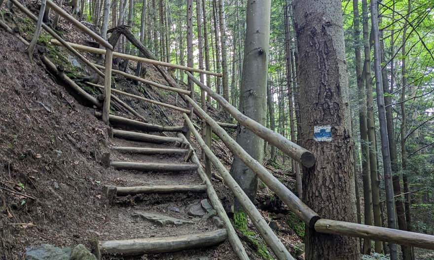
Start of the Blue Trail to Mosorny Groń
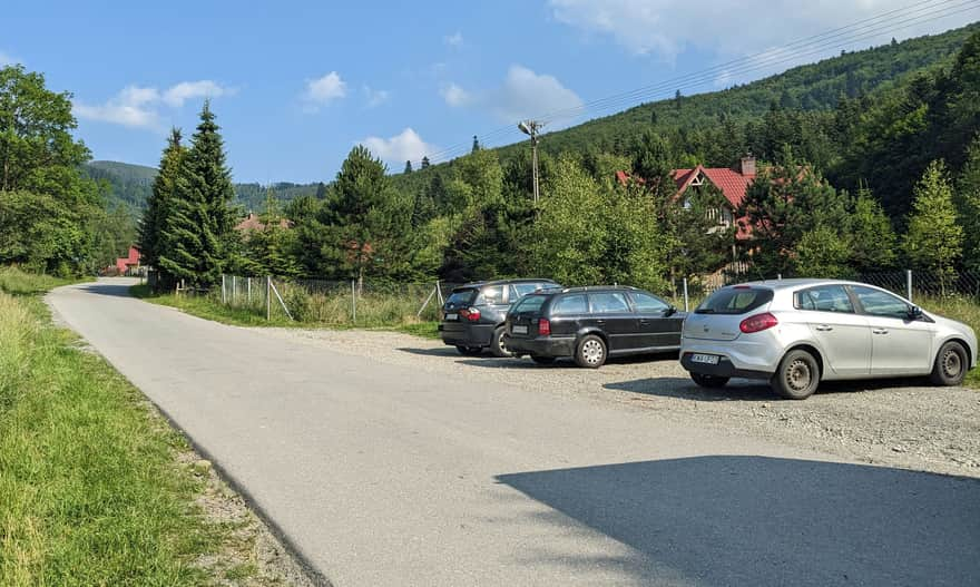
Right at the entrance of the blue trail from the asphalt road into the forest, there is a small parking area for a few cars.
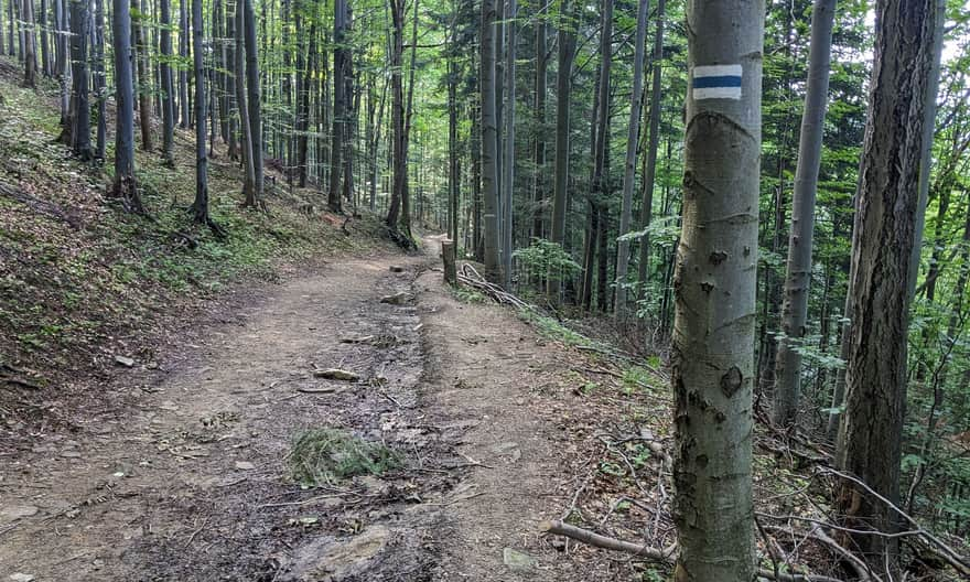
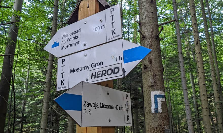
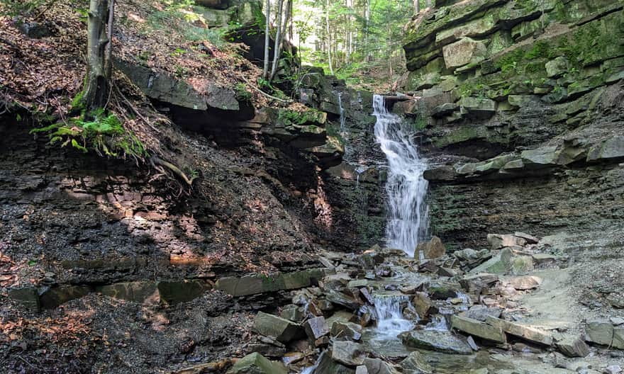
The path along the stream climbs up, then slightly descends, and after about 20 minutes, it reaches the descent to the waterfall.
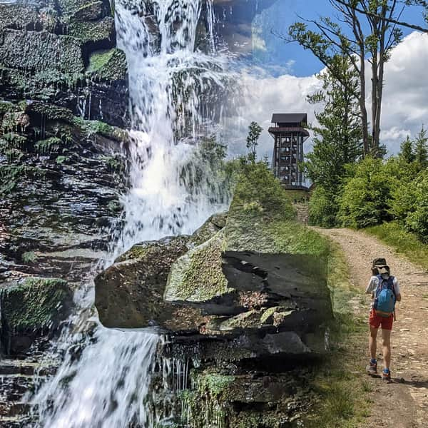
Waterfall on Mosorny Stream
A short, steep path with a wooden railing might be difficult for small legs – some steps are very high.
But it's definitely worth it: the waterfall, surrounded by rocks and reaching a height of 8 meters, is beautiful!
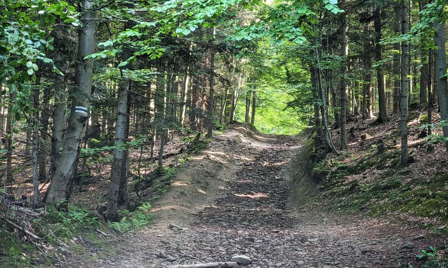
Climbing to the Top of Mosorny Groń - Yellow Trail
The blue trail continues through the forest uphill. Some sections are quite steep and tiring. Fortunately, there are many flat areas to rest.
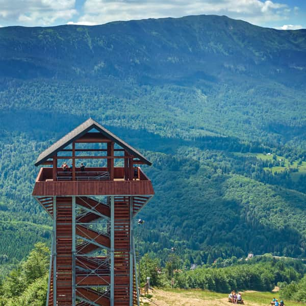
After reaching the ridge and the intersection with the yellow trail, we leave the blue signs (which go left) and turn right. The lookout tower, and thus the top of Mosorny Groń, is right in front of us.
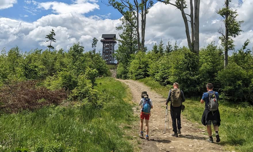
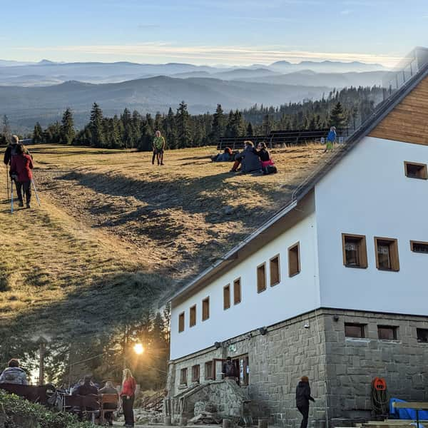
Mosorny Groń - Attractions at the Top
From the pass, it's only 5 minutes to Mosorny Groń, where you'll find the upper station of the cable car and a restaurant (serving meals, sweets, ice cream, drinks). And most importantly – a beautiful view of Babia Góra! From the lookout tower, you can even see the Tatra Mountains.
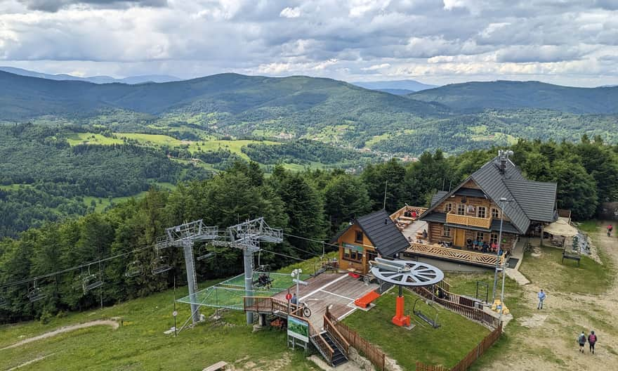
More about Mosorny Groń, the tower, views, cable car, attractions, and other trails to the top:
Mosorny Groń - observation tower, trails, attractions
Mosorny Groń (1047 meters above sea level) is a peak in the Polic Range, at the foot of Babia Góra. The new observation tower offers beautiful panoramas of the surrounding ranges: Babia Góra, Polic Range, Jałowiec Range. On a clear day, you can even see the Tatra Mountains! ...
Return to Zawoja from Mosorny Groń
You can return the same way (the descent takes about 45 minutes), or take the cable car down to Zawoja - Policzne.
If you consider climbing or descending Mosorny Groń via the yellow trail, keep in mind that it intersects with several bike trails (3 MTB routes), which can sometimes be dangerous for pedestrians. From our observations, mountain bikers made up the majority of cable car passengers: they would ride up to Mosorny Groń and then speed down, heading towards the yellow trail...
You can also continue along the ridge on the yellow trail towards Cyl Hala Śmietanowa (1 hour, 2 km one way), to Polica (about 2 hours, 4.5 km one way), or even to the shelter on Hala Krupowa (2.5 hours, almost 7 km one way).
PS. This route has been included in our article "Around Babia Góra. Trails around Zawoja." Want to know more about them?
Around Babia Góra. Trails in the vicinity of Zawoja
Where to go for a mountain hike from Zawoja? Not just to Babia Góra! The surrounding mountain ridges offer kilometers of beautiful scenic trails accessible to everyone! ...


Publish Date:
Last Updated: