From Mosorny Groń to Polica via Kiczorka (Cyl Hali Śmietanowej)
Nearby: Sucha Beskidzkabeach_access Route in the shade
restaurant Restaurant or bar nearby
wc Toilet along the route
The trail from Mosorny Groń to Kiczorka (Cyl Hali Śmietanowej) and further to Polica is a relatively easy mountain walk. It's good to know that even though the path goes through a forested ridge, there will be some steep climbs along the way. Our effort will be rewarded with several points offering beautiful views and the satisfaction of reaching the highest peak in the Beskid Mountains, located entirely within Poland!
How to get to Mosorny Groń?
The easiest way is by taking the year-round chairlift from Zawoja Lajkonik. You can also choose one of the hiking trails to the top. Once at the top, be sure to visit the viewing tower. For more details on what awaits you at the top of Mosorny Groń and how to get there, read here:
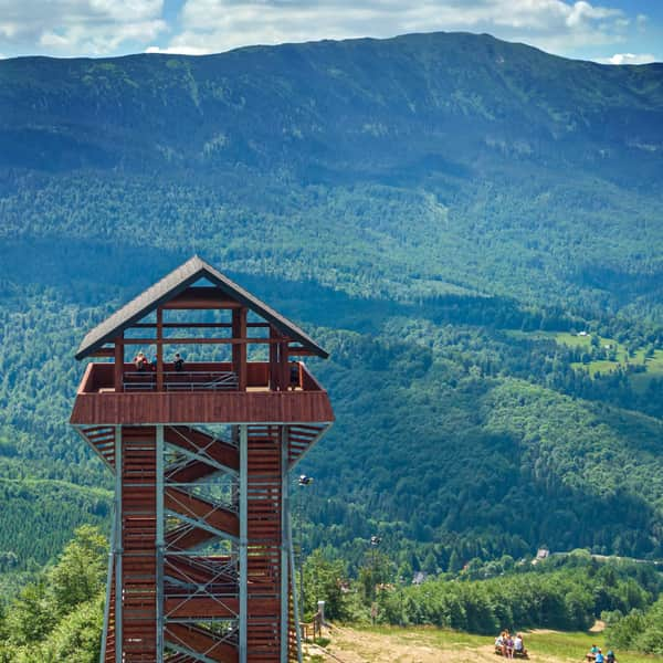
Mosorny Groń - observation tower, trails, attractions
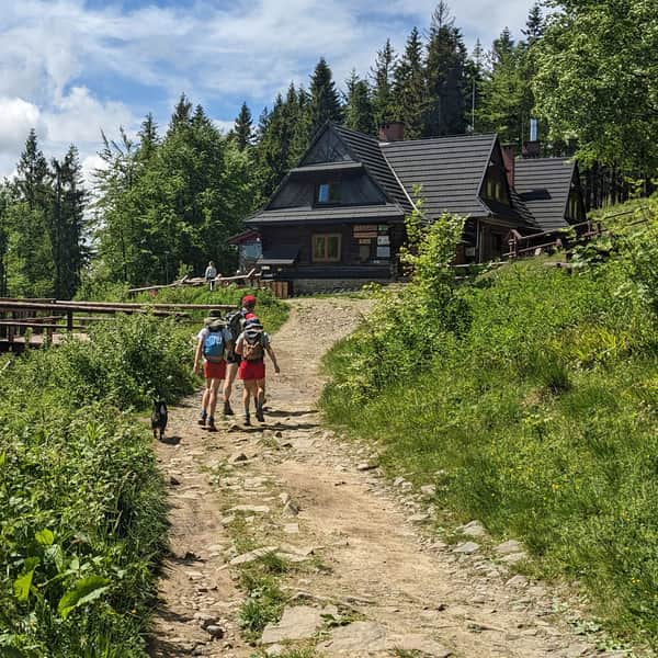
Mosorny Groń (1047 meters above sea level) is a peak in the Polic Range, at the foot of Babia Góra. The new observation tower offers beautiful panoramas of the surrounding ranges: Babia Góra, Polic Range, Jałowiec Range. On a clear day, you can even see the Tatra Mountains! ...
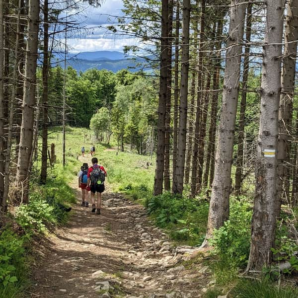
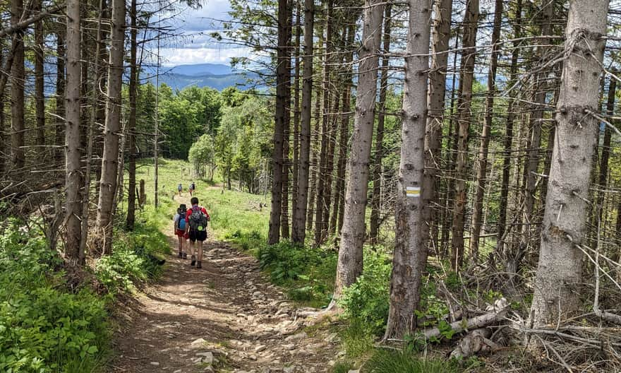
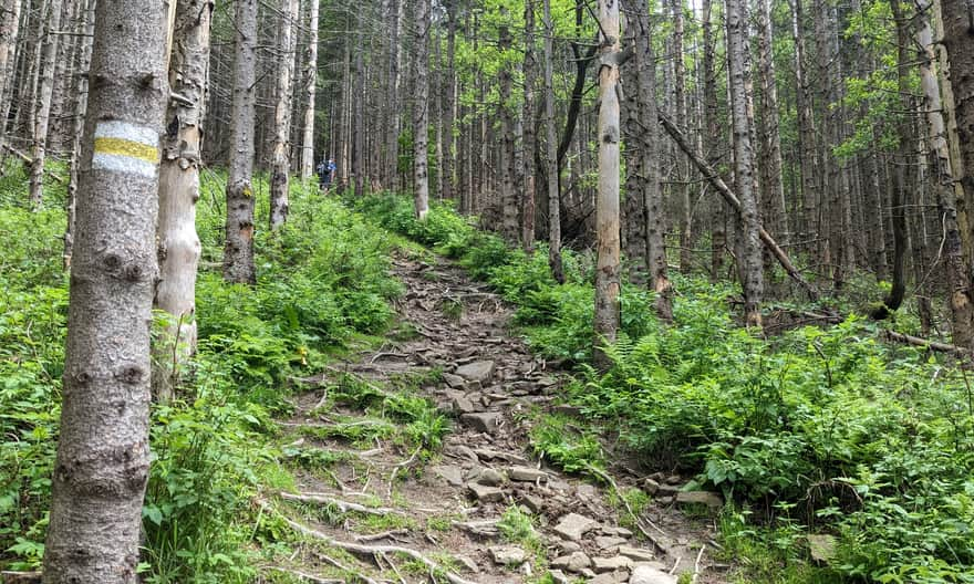
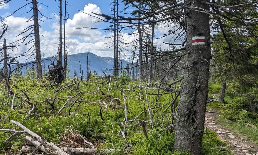
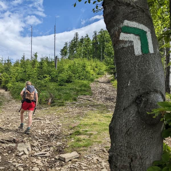
Yellow trail from Mosorny Groń to Cyl Hali Śmietanowej (Kiczorka)
The yellow trail from the top of Mosorny Groń will take you directly to Cyl Hali Śmietanowej (1298 meters above sea level) in about 1 hour. The distance to cover is 2 km, but there is also a height difference of over 250 meters.
Initially, the trail leads along a wide ridge road. However, the closer you get to the goal (Cyl), the steeper it becomes. The climb to the very top is really demanding and tiring, but fortunately short.
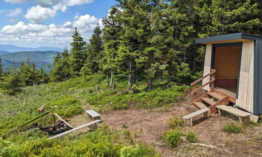
Cyl Hali Śmietanowej, 1298 meters above sea level
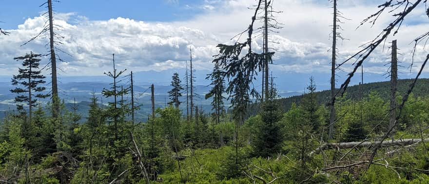
At the top, there is a small clearing and a covered shelter. It's worth stopping here to admire the view of the Babia Góra massif, Mędralowa, and Jałowiec, as well as Pilsko, Rysianka, and Romanka peeking out from behind them. In the far distance, you can also see the Silesian Beskids, including Skrzyczne.
...and where is Hala Śmietanowa?
The actual Hala Śmietanowa, where sheep were grazed a hundred years ago, has unfortunately grown over with young forest. Its name came from the Śmietan family from Skawica.
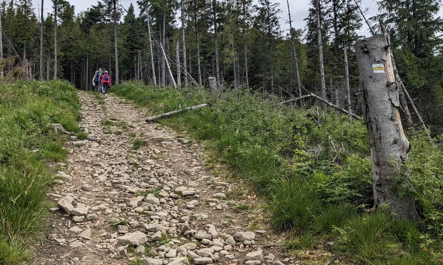
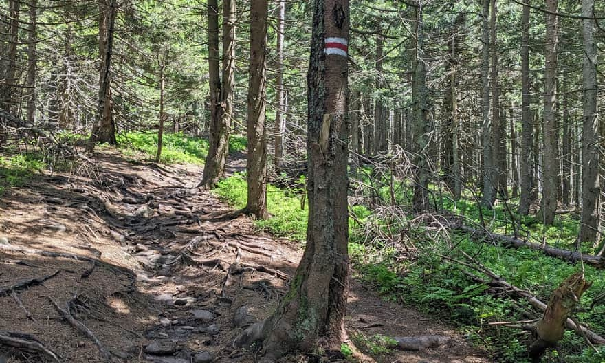
Red trail from Cyl Hali Śmietanowej to Polica
From Cyl Hali Śmietanowej to the highest peak of the range, Polica, the red trail leads - a section of the Main Beskid Trail. This part of our route is also 2 km long, but due to the smaller height difference, we will cover it much faster.
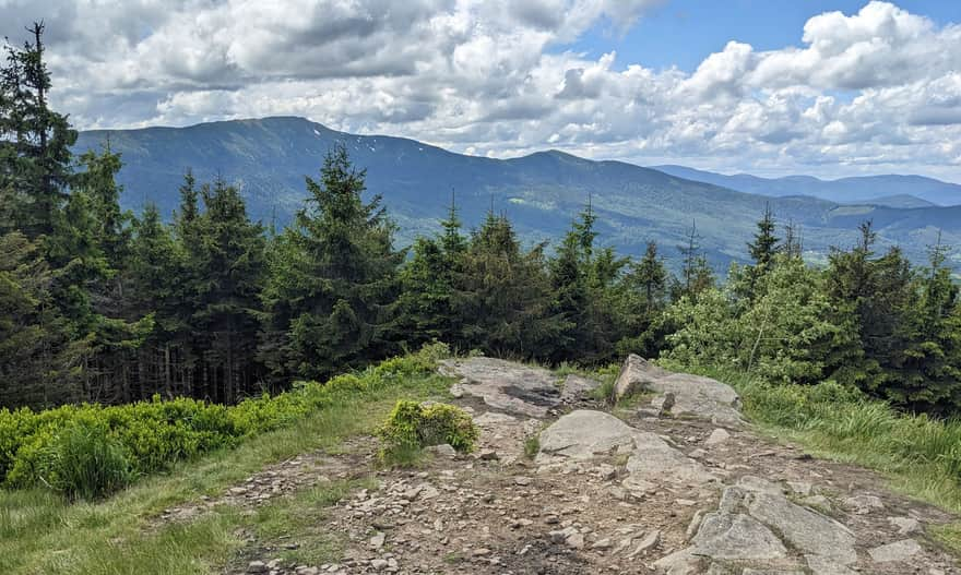
From the south, through the sparse forest, we are accompanied by a view of Babia Góra:
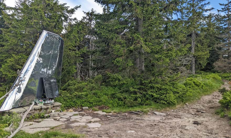
Just before the summit of Polica, there is a memorial site for the victims of the plane crash on April 2, 1969:
Polica, 1369 meters above sea level
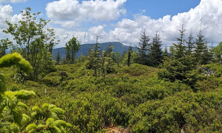
A few meters from the monument is the summit of Polica... and a large field of blueberries! From the very top of Polica, you will only see Babia Góra. For wider panoramas, you need to descend through the blueberry fields. With good visibility, you can see the Tatra Mountains, Pieniny, and Gorce.
Back from Polica to Mosorny Groń
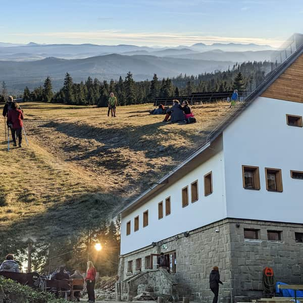
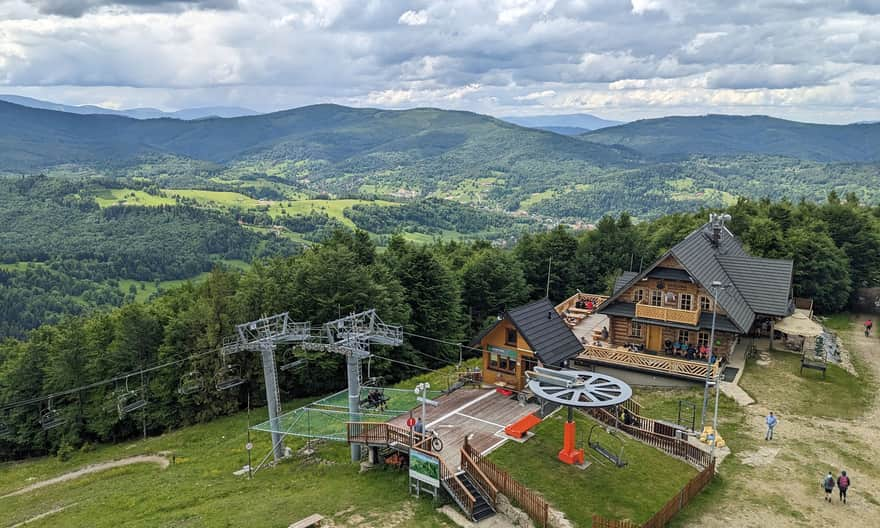
Descending from Polica back to Mosorny Groń will take about 1 hour. If you have more time, it's worth visiting the PTTK shelter on Hala Krupowa - just 2.5 km (about 40 minutes) from the summit of Polica. Here you can also enjoy beautiful views of the Tatra Mountains and Podhale, as well as simple bar dishes, snacks, and drinks.
The PTTK Shelter on Hala Krupowa - trails, views, curiosities
The PTTK Shelter on Hala Krupowa is a picturesque and scenic place in the Żywiec Beskids, near the summit of Policy (1369 meters above sea level). It can be a destination for a mountain trip or a stop during a longer hike through the Polic Range. ...
Green trail Hala Krupowa - Mosorny Groń
Returning from Hala Krupowa to Mosorny Groń, consider taking the green trail, which is slightly longer but avoids the peaks of Polica and Cyl Hali Śmietanowej. This way, you won't have to climb Polica again and will have the chance to observe different views: this time to the north of the Polica range.
Medium
Mosorny Groń - PTTK Shelter on Hala Krupowa: blue and green trail

Loop around the summit of Polica
The green trail is certainly not as attractive as the red one, which passes through the peaks of Polica and Cyl Hali Śmietanowej. However, it's worth considering when starting from Mosorny Groń or Hala Krupowa and Kucałowa Pass and wanting to return to the starting point by a different route.
Due to the steep climb on the yellow trail between Mosorny Groń and Cyl Hali Śmietanowej, we suggest starting from Hala Krupowa to first climb Polica and Cyl via the red trail and descend the yellow trail to Mosorny Groń, then return via the green trail. On the other hand, starting from Mosorny Groń, first choose the green trail, and on the way back from Hala Krupowa, climb Polica and Cyl Hali Śmietanowej via the red trail.


Publish Date: