Chuda Przełączka - Loop from Kościeliska Valley
Nearby: Zakopanewb_sunny Route in the sun
The loop through Chuda Przełączka is an interesting, scenic, and technically easy trail suitable for older children who can handle the elevation change. The trail made an amazing impression on us!
- The trail is physically demanding but should not pose major technical difficulties.
- It can be an interesting alternative to the Red Peaks ridge trail, as it is shorter and easier but still very scenic.
Getting There and Starting the Trail - Kościeliska Valley
The trail starts in Kościeliska Valley. You can reach the village of Kiry by bus from Zakopane or by your own car. At the beginning of the valley, there are several large paid parking lots, inns, and stalls. There is a paid entrance to the Tatra National Park. You can read more about the valley and its attractions here: Kościeliska Valley
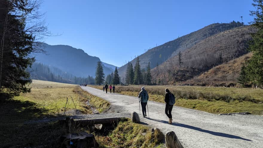
At the characteristic bridge in Kościeliska Valley, turn left and follow the red trail to Ciemniak (2096 meters above sea level).

Red Trail to Ciemniak
The beginning is not easy - the path is steep and climbs sharply. You will quickly overcome the steepest rocky section, which looks intimidating but is not difficult or dangerous to pass, at least on a dry and non-winter day.
An interesting feature here is the presence of Tatra paleoendemics. These are plants that grew in the Tatras before the glaciation period, making them the oldest species. They survived the ice age because they grew in areas not completely covered by ice.


The quickly gained height will allow us to admire increasingly beautiful views that will start to appear after just a few minutes of walking. Turning around, you will see Kościeliska Valley and Hala Stoły, and to the right of them, Przysłop Miętusi and the Giewont massif.


Piec Peak (1460 meters above sea level)
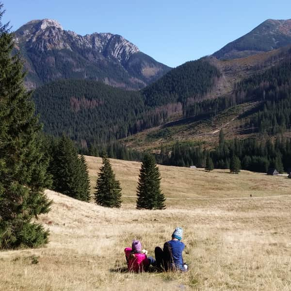
This is one of the most characteristic places on the route. The limestone rock separates Kościeliska Valley from Miętusia Valley. From here, you can see Giewont, although from the side, making it hard to recognize the silhouette of the sleeping knight. The flat and scenic spot under Piec is a favorite resting point for tourists - no wonder, as you go to the mountains for such views!


Chuda Przełączka near Red Peaks
This place is under the summit of Ciemniak at an altitude of 1850 meters, with a trail intersection. Chuda Przełączka separates Miętusia Valley from Tomanowa Valley. We have reached the highest point of our loop. The Red Peaks are worth seeing in autumn when the grass called 'sit skucina' turns the slopes red, giving the massif its name.

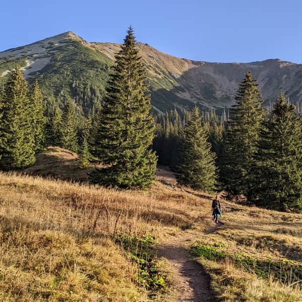
Descent to Tomanowa Valley
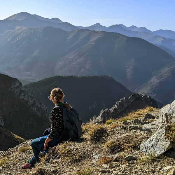
This is a very picturesque part of the route, the trail is exposed here, but the passage is quite safe. The views are breathtaking, and you will want to enjoy the surrounding panorama at every step.


Tomanowa Valley
This is one of the least frequented Tatra valleys. The valley itself is mostly forested, and the path through it is rocky. The valley lies on the main route of wild animal migrations. In spring, you often see bear tracks on the melting snow, and deer rutting also takes place here. In 2004, three dinosaur tracks from the Upper Triassic were found in the Red Gully - they are now in the Tatra National Park Natural History Museum. Once, most of the valley was cleared and grazed. Sheep grazing stopped after a strict nature reserve was established here.
Medium
Tomanowa Valley in the Tatra Mountains


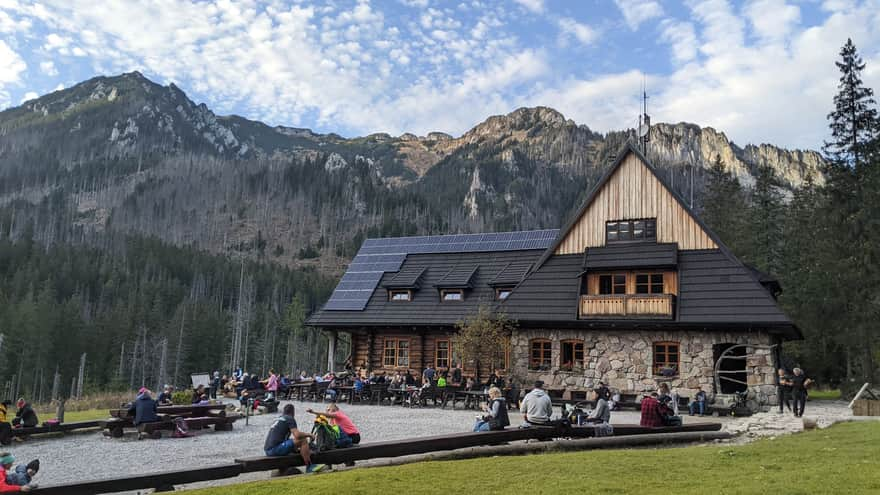
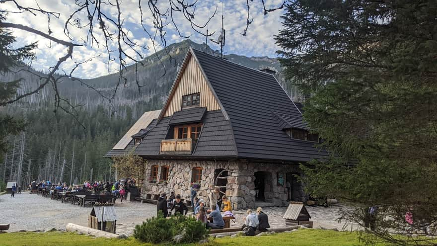
Ornak Shelter
Through Tomanowa Valley, we reach the Ornak shelter, where we can rest and eat something warm. We return to the parking lot and the village of Kiry through Kościeliska Valley.

Publish Date:
More in the Region Zakopane (Zakopane)