Blue Trail to Wielka Rawka
Nearby: Ustrzyki Dolnebeach_access Route in the shade
directions_car Access by car
warning No dogs allowed
The Blue Trail to Wielka Rawka from Rzeczyca and Ustrzyki Górne is a beautiful forest route. After climbing through the beech forest, we can enjoy magnificent views from the vast meadows on Wielka and Mała Rawka, as well as the opportunity to reach the tripoint of borders on Krzemieniec (Kremenaros).

Starting point of the Blue Trail to Wielka Rawka: Ustrzyki Górne and Rzeczyca
If we are starting our hike using public transportation, we start from Ustrzyki Górne and have to walk about 2 km uphill along the Rzeczyca river valley on an asphalt road. If we can drive, we can leave our car in the parking area where the trail enters the forest.

In addition to the parking area, there is also a ticket office for the Bieszczady National Park (tickets, souvenirs, restroom) as well as tables and benches.
Blue Trail to Wielka Rawka
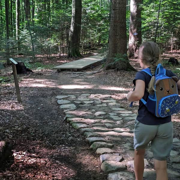
The first section of our forest trail is a pleasant walk along a gently ascending wide path. We cross the Rzeczyca river and walk up one of its tributaries.

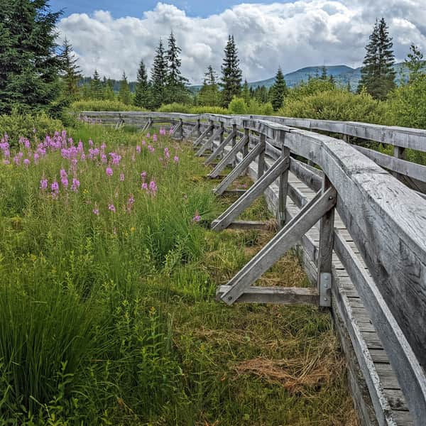
Many parts of the trail are built on wooden walkways or steps, which make the hike much easier, especially after rainfall in spring or autumn.
Nature Trail "Wielka Rawka"
An additional attraction on the trail are the stops of the "Wielka Rawka" nature trail (a detailed guide to each stop can be purchased at the ticket office). The trail has a total of 46 stops. The first one is located at the Rzeczyca parking area, and the last one is at the Wyżniańska Pass parking area.

The nature trail also helps us keep track of "how far is left" to the summit. Stops number 26 and 27 await us at the peaks of Wielka Rawka, and stop number 33 at Mała Rawka.
Ascending Wielka Rawka via the Blue Trail
Approximately halfway through our journey, about 1 hour from the parking area, we will find a sheltered gazebo. It's a good place to rest and gather strength because it will soon start getting steeper! The path will ascend through a beautiful beech forest.


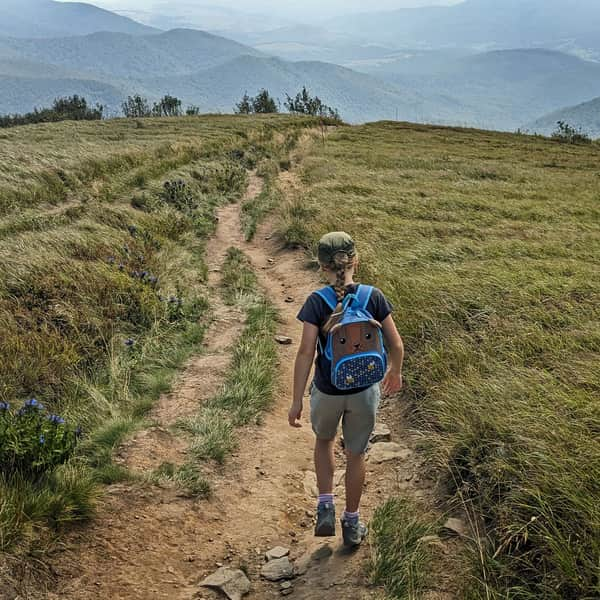
On a small clearing, we will be able to see our destination: the ridge of Wielka Rawka with a distinctive concrete pillar on the summit. Just a little more climbing between dwarf rowans, and we will reach the top! Well, the "first summit".


Wielka Rawka - summit at 1304 m above sea level
Our Blue Trail reaches a sign that says "Wielka Rawka", but it's not yet the "real" Rawka that we conquer, only its side peak.

Nevertheless, the views from here are already enchanting! Behind us, to the east: Caryńska Polonina in all its glory.

To the southeast: the "Tarnica nest".

And to the north: in the foreground, Mała Rawka, and in the background, Wetlińska Polonina.

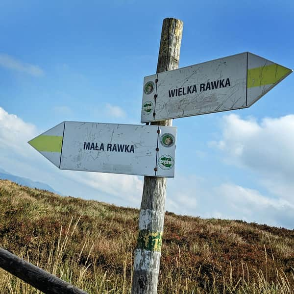
To reach the summit, we follow the yellow trail to the right and after about 300 meters of a pleasant scenic walk, we reach the highest point marked by a large concrete pillar.

More information about both Rawkas, the views, and other trails leading here:
Small and Big Rawka. All trails to Rawki
Rawki, or Big Rawka (1307 m above sea level) and Small Rawka (1272 m above sea level) are scenic peaks in the Bieszczady Mountains, famous for their beautiful meadows and panoramic views in all directions. How to get there and which trail to choose for Rawki? What can you see from Small Rawka and Big Rawka? ...
Wielka Rawka - What's next?
We can return to the Rzeczyca parking area using the same trail - the descent on the Blue Trail takes about 1 hour (to the center of Ustrzyki Górne - about 1.5 hours).
We can also continue further on the yellow trail to Mała Rawka (about 20 minutes), and from there descend on the green trail through Bacówka pod Małą Rawką to the Wyżniańska Pass (about 45 minutes). Here, we can try to catch a bus or hitchhike to return to Ustrzyki Górne (6 km on an asphalt road).
From Wielka Rawka, it is also worth taking a walk to Krzemieniec / Kremenaros, which is the famous tripoint of the borders of Poland, Ukraine, and Slovakia (2 km, about 40 minutes one way).
Medium
From Mała and Wielka Rawka to Krzemieniec / Kremenaros

Publish Date:
More in the Region Bieszczady (Bieszczady)