
Sokolica - trails to the scenic peak in the Pieniny Mountains
Sokolica (747 meters above sea level) is a scenic peak in the Pieniny Mountains. From here, you can see the picturesque Dunajec River Gorge, nearby Pieniny and Beskid hills, and the Tatra Mountains. What should you know about Sokolica and which trail to choose to reach the top?
Why Sokolica? Attractions at the top.
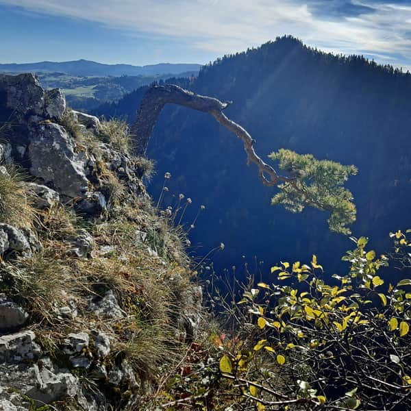
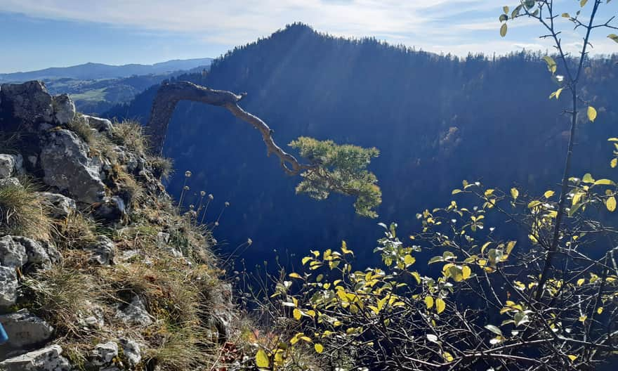
Although it is not the highest peak in the area - it is surpassed by the neighboring Czerteż (774 meters) and Trzy Korony (982 meters) - it remains very popular. It is relatively easy and quick to access, and here you can see the most famous pine tree in Poland! Did you know that its photogenic nature has amazed tourists and artists for almost 200 years? In the mid-19th century, it was painted by Józef Szalay, the creator of the Szczawnica spa, and an album with photos from the peak was published by Franciszek Wyspiański, the father of Stanisław.
Views from Sokolica
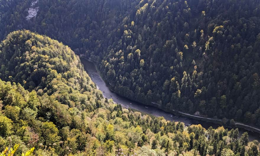
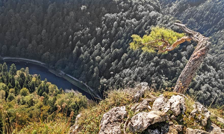
Although the peak of Sokolica is not as elevated above the surroundings as, for example, Trzy Korony, it offers a beautiful view of the Dunajec Gorge and the Trzy Korony Massif (from the back). To the east, you can see the Małe Pieniny with Wysoka and Wysoki Wierch, and behind them, the Radziejowa Range in the Sądecki Beskid.
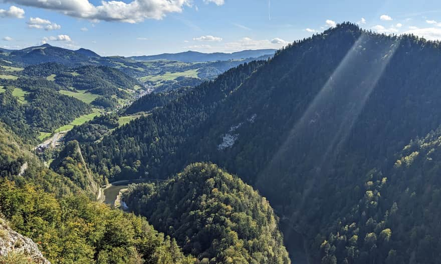
In the Sokolica area, there is the so-called Loch, the deepest place in the Dunajec Gorge. The water depth here reaches up to 9 meters.
How to reach Sokolica?
If you want to reach the top of Sokolica, you have several trails to choose from: from Szczawnica via the Pieniny Road, from Krościenko nad Dunajcem, or from Sromowce Niżne.
The shortest trail to Sokolica - from Szczawnica via Dunajec
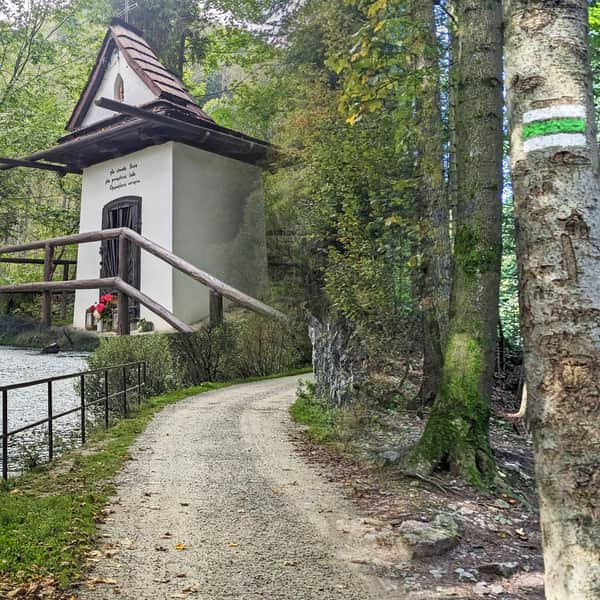
The blue trail from Szczawnica to Sokolica is indeed the shortest and therefore the most popular (and the most crowded in the season). An additional attraction is the raft crossing over the Dunajec River. Note: the crossing is only possible at specific times and only from May to October.
Medium
Sokolica - Trail from Szczawnica


The easiest trail from Krościenko to Sokolica
If you don't want to cross the Dunajec, consider reaching Sokolica from Krościenko nad Dunajcem. The trail initially follows the riverbank, and a steeper climb awaits in the second half of the trail.
Medium
Sokolica from Krościenko - the easiest trail

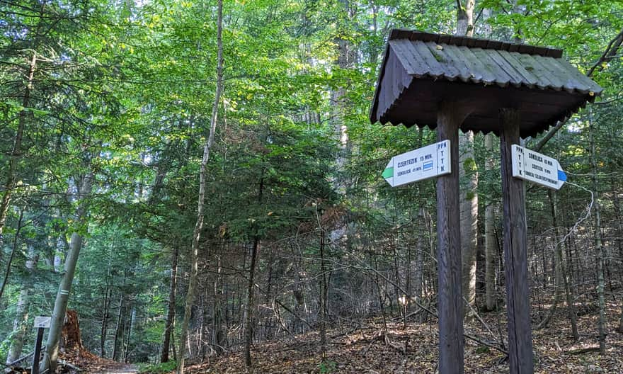
Other trails to Sokolica from Krościenko
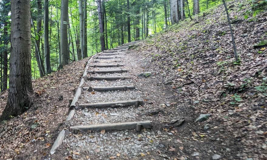
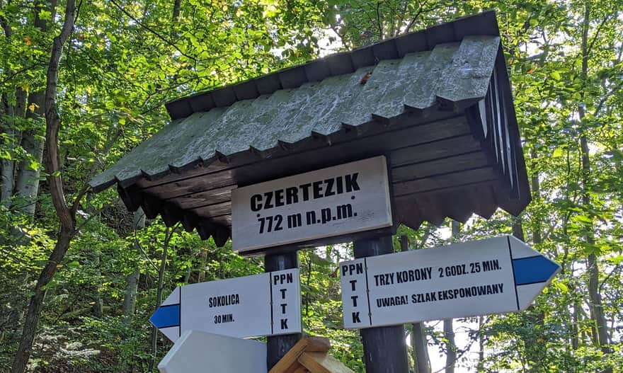
From Krościenko nad Dunajcem, you can also reach the top of Sokolica via the so-called Sokola Perć, passing the scenic peaks of Czertezik and Czerteż. Note! This trail goes through rocky, narrow, and exposed paths, including wooden, steep ladders. The route Krościenko > yellow trail > Bajków Groń > blue trail: Czerteż - Czertezik - Sokolica is 5 km, with a 580-meter elevation difference, taking about 2 hours one way.

It will be a bit easier if, after leaving Krościenko, you turn left at the Toporzysko clearing from the yellow trail to the green signs. This way, you will avoid the most difficult part of Sokola Perć through Czerteż. You will join the blue trail only at Czertezik (viewpoint). The route Krościenko > green trail > Czertezik > blue trail - Sokolica is 4 km, with a 500-meter elevation difference, taking about 1:45 hours one way.
To Sokolica from Sromowce Niżne
Another idea to reach Sokolica is to approach it from the south. Starting from Sromowce Niżne, you will see the beautiful Szopczański Gorge and the scenic Szopka Pass along the way. From here, you can either go straight to Bajków Groń and then via Sokola Perć (steep, narrow paths with ladders) or follow the blue trail to Trzy Korony and the Pieniny Castle.

Starting from Sromowce Niżne, you have 3 routes to choose from:
- Route Sromowce Niżne > yellow trail: Szopczański Gorge > Szopka Pass > Bajków Groń > blue trail: Sokola Perć (Czerteż, Czertezik) > Sokolica is 7 km one way, with a 650-meter elevation difference, taking about 2:45 hours.
- Route Sromowce Niżne > Szopczański Gorge > Szopka Pass > blue trail to Trzy Korony > Pieniny Castle > Bajków Groń > Sokola Perć (Czerteż, Czertezik) > Sokolica is 10 km one way, with a 930-meter elevation difference, taking about 4 hours.
- The third route from Sromowce Niżne to Sokolica follows the green trail to the Kosarzyska clearing (bypassing Szopczański Gorge, Szopka Pass, and Trzy Korony), then the blue trail through Pieniny Castle, Bajków Groń, Sokola Perć (Czerteż and Czertezik) to Sokolica. This route is 8.5 km one way, with a 780-meter elevation difference, taking about 3.5 hours.
Sokolica - facts and curiosities
Like many Pieniny peaks, Sokolica has many stories. So what else is worth knowing about Sokolica?
Where does the name Sokolica come from?
Of course, from falcons! These birds used to nest on the inaccessible Pieniny peaks. Unfortunately, increased tourist traffic caused them to move to quieter habitats. Since the 1990s, naturalists have been working to restore this species of birds of prey in the Pieniny - and apparently with good results! The first pairs have already managed to raise young.
Names of rocks on Sokolica: Sugar Head and Wolf Rocks
Just like the rocks on Trzy Korony, the rocks on Sokolica also have their names. These include Kazalnica, Rygle Sokolicy, Sugar Head (shaped like a sugar loaf), and Wolf Rocks. Between Sugar Head and Wolf Rocks, there is also a rocky valley called "Wolf Drop." It is said that a wolf once fell here while hunting a deer.
The pine on Sokolica - does it remember the Ice Age?
The most famous pine in Poland is the so-called relict pine. This means that this species of dwarf pine originated during the last glaciation when plants had to adapt to harsh conditions. Since then, the climate has changed, but the pines have retained their old form.
In summary: the pine on Sokolica itself does not remember the Ice Age, but it is the great-great-great... granddaughter of pines that lived here in those extremely harsh conditions and inherited its unique shape from them.
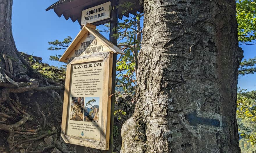
How old is the pine on Sokolica?
Pieniny pines are among the oldest in Poland. Some specimens from Sokolica are about 550 years old! The age of the most famous and photogenic one is also estimated to be around 500 years.
Who broke the pine on Sokolica?
The pine on Sokolica used to look different than it does today... In 2018, one of its branches was broken during a rescue operation. It was damaged by a strong gust of wind from the rotor of a GOPR helicopter. Fortunately, the pine did not die and still adorns the top of Sokolica in a slightly "trimmed" form.
Sokolica - practical information
- Sokolica is located in the Pieniny National Park, where dogs are not allowed.
- Entrance is paid (ticket booth is just below the peak, discount with KDR).
- The Dunajec crossing on the blue trail operates only from May to October. From November to April, you need to choose another trail.
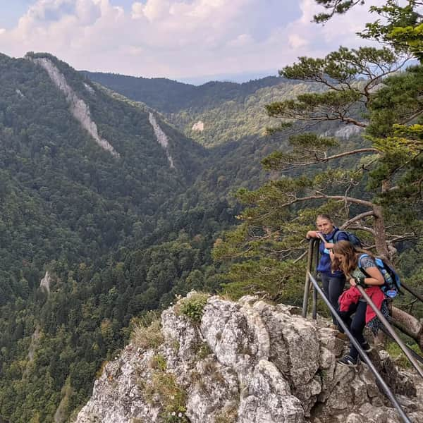
- There is very little space at the top of Sokolica. On weekends and during the holiday season, expect a queue to reach the peak.
- The approach to the rocky peak is steep and leads over slippery limestone rocks. Proper footwear is necessary, and it is very slippery just after or during rain!
- A metal railing separates the peak from a 300-meter cliff. As you can see in the photos, it is not 100% secure and does not relieve you of the need to be cautious and take special care of the youngest! Unfortunately, fatal accidents have occurred here...


Publish Date:
Last Updated: