
Barania Góra - trails, tower, views and trivia
Barania Góra, at 1215 meters above sea level, is the second highest peak of the Silesian Beskids, known primarily for being the source of the Queen of Polish Rivers - the Vistula. Barania Góra also offers beautiful panoramas, a viewing tower and a shelter with a mini-museum. What should you know about Barania Góra? What trails lead to the summit and which one to choose?
Barania Góra, 1215 m above sea level - peak and attractions
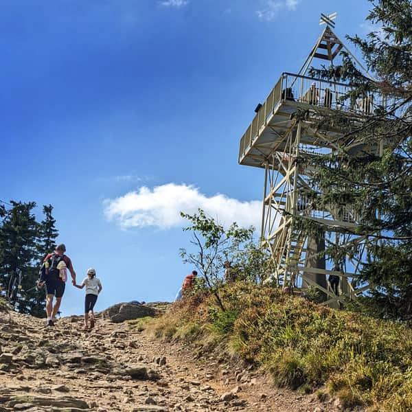
Would you believe that not so long ago there were no views from Barania Góra? The peak was completely forested, marked by an obelisk and a wooden structure - a triangulation tower. The situation changed only in 1991, when a 15-meter tower was built here, the rest was done by bark beetles and windfalls...

Views from Barania Góra
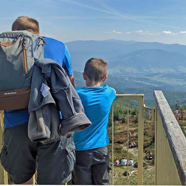
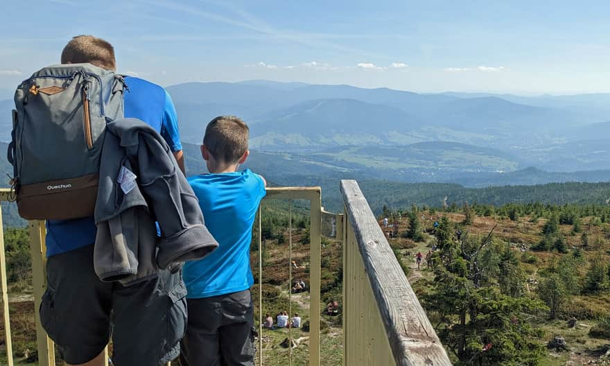
Today, from the wide blueberry-covered glades at the top of Barania Góra, you will see a very wide panorama: from Malinowska Rock and Skrzyczne in the north, the Small Beskid in the north-east, the Żywiecki Beskid with Babia Góra and Pilsko in the east, all the way to the Tatra Mountains.

Viewing tower on Barania Góra
Although not very high, the 15-meter tower will take us above the treetops.

Thanks to this, in addition to the views available from the blueberry meadows, we will also see views to the west: including the Stożek and Czantoria ranges. Moreover, on the tower, we will find boards with a description of individual peaks:

Viewpoint rock on Barania Góra
Another interesting place at the top is a picturesque rock outcrop. It may not be as photogenic as the nearby Malinowska Rock, but we don't have to queue for it, and the pictures and views are also amazing!

Barania Góra and shelter: PTTK Shelter at Przysłop under Barania Góra
Have you heard that there is a shelter on Barania Góra? Yes, but only about 3 km below the summit and almost 300 m lower, on the Przysłop Glade. It is also worth visiting due to the small museum: PTTK Mountain Tourism Culture Center.
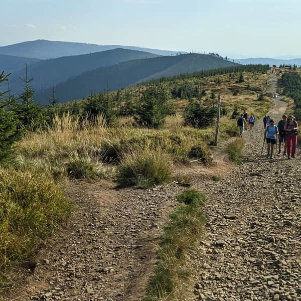
Trails to Barania Góra
Many trails of varying difficulty lead to Barania Góra. Which one to choose?

The shortest trail to Barania Góra
We can get to the top of Barania Góra the fastest by the blue trail through the Biała Wisełka Valley. The length of this route is less than 7 km, we have to overcome a height difference of about 650 m. The hike to the top should take us about 3 - 3.5 hours.
Attractions of this trail include a picturesque valley with a waterfall (Rodła Cascades), and on a hot day a big plus will be that we are walking almost all the time in the forest. Minus - this route does not pass by the shelter on the Przysłop Glade.
Medium
Barania Góra - blue trail through Biała Wisełka and Rodło Cascades


Cable car to Barania Góra?
No, we can't take a cable car to Barania Góra. The nearest year-round cable car is located on Małe Skrzyczne, about 8 km from the top of Barania Góra. If we don't really like (or can't climb) it is worth considering such a possibility.
After taking the cable car (first a gondola, then a "sofa") we have to walk the ridge trail through Malinowska Rock. It will be very scenic and in total less than 400 m uphill, it will only get steep before the very top.
Medium
Scenic ridge trail: Skrzyczne - Barania Góra


Other trails to Barania Góra
- Black trail through Czarna Wisełka Valley - this is probably the most popular route to Barania Góra, a big plus of which is that it passes through the shelter on the Przysłop Glade and passes the source of the Vistula, i.e. the outflows of Czarna Wisełka (9 km, 650 m elevation gains, approx. 3.5 hours one way). It can be combined in a loop with the blue trail through the Biała Wisełka Valley.
- Red from Szarcula Pass - less popular than black, slightly longer, on the way we also "check off" the shelter on the Przysłop Glade and pass the source of the Vistula, i.e. the outflows of Czarna Wisełka (10 km, 618 m elevation gains, approx. 3:40 hours one way).
- Yellow through Cieńków + green through Magurka Wiślańska - (12 km, 880 m elevation gains, approx. 4.5 hours one way). It can be combined in a loop with the blue trail through the Biała Wisełka Valley.
- Black from Kamesznica: 7.5 km, 718 m elevation gains, approx. 3 hours one way
- We can also reach Barania Góra from Węgierska Górka. There are two routes from there, which can be combined into an ambitious, all-day loop (a total of 26 km, 9 hours, 1300 m elevation gains). This is the red trail: 13.5 km, over 1000 m elevation gains, approx. 5 hours one way, and the green + black trail: 12.5 km, over 1110 m elevation gains, 5 hours one way.
Barania Góra - facts and trivia
Although Barania is not the legendary Babia Góra, there are also several interesting stories about it!

Where does the name Barania Góra come from?
Apparently, unlike the neighboring peaks, which were often used for grazing animals, the forested, steep slopes of Barania Góra remained outside the interest of the valley inhabitants for a long time. Even so, one of the stories associates its name with pastoralism. Apparently, a fire broke out in the forest on the slopes of the mountain, in which 300 grazing rams died.
First conquerors of Barania Góra
Barania Góra began to attract interest very late: it was neither the highest in the area nor did it offer special views. The first conqueror of it is said to be Prince Ludwig Anhalt-Coethen of Pszczyna, who noted that he had conquered the summit of Barania Góra in the summer of 1810.
In the middle of the 19th century, the Habsburgs from Cieszyn organized hunts on the slopes of the mountain. They also built a wooden hunting castle on the Przysłop Glade (1897). After regaining independence, a tourist shelter was opened in it (1925), and next to it... a ski jump! Only then was a network of hiking trails in the area marked out. After the construction of a new, brick shelter (1979), the old wooden building was moved to the center of Wisła.
Where is the Source of the Vistula on Barania Góra?
You have probably heard that the source of the Vistula is on Barania Góra, but where to look for it? The matter is not that simple... First of all, the Vistula does not have a source but so-called "outflows", i.e. trickles of water seeping on a wet meadow, which join into larger streams and streams. In addition, there are two such "outflow" places: one belongs to Czarna, the other to Biała Wisełka. And one more thing: both are in a reserve, off the trails, so we can't legally get there...
The more important place, recognized as the "official source of the Vistula" (outflows of Czarna Wisełka) is located near the trail between the shelter and the top of Barania Góra, more precisely under the peak of Wierch Wisełka. Due to the thinning of the forest after windfalls, it can reportedly be seen to the east of the path (on the right going towards the top).
If you feel like going in search of the sources of the Vistula, we recommend the "classic loop": ascent to Barania Góra by the blue trail, up the Biała Wisełka Valley, and descent through the shelter and the Czarna Wisełka Valley by the black trail:


Publish Date:
Last Updated: